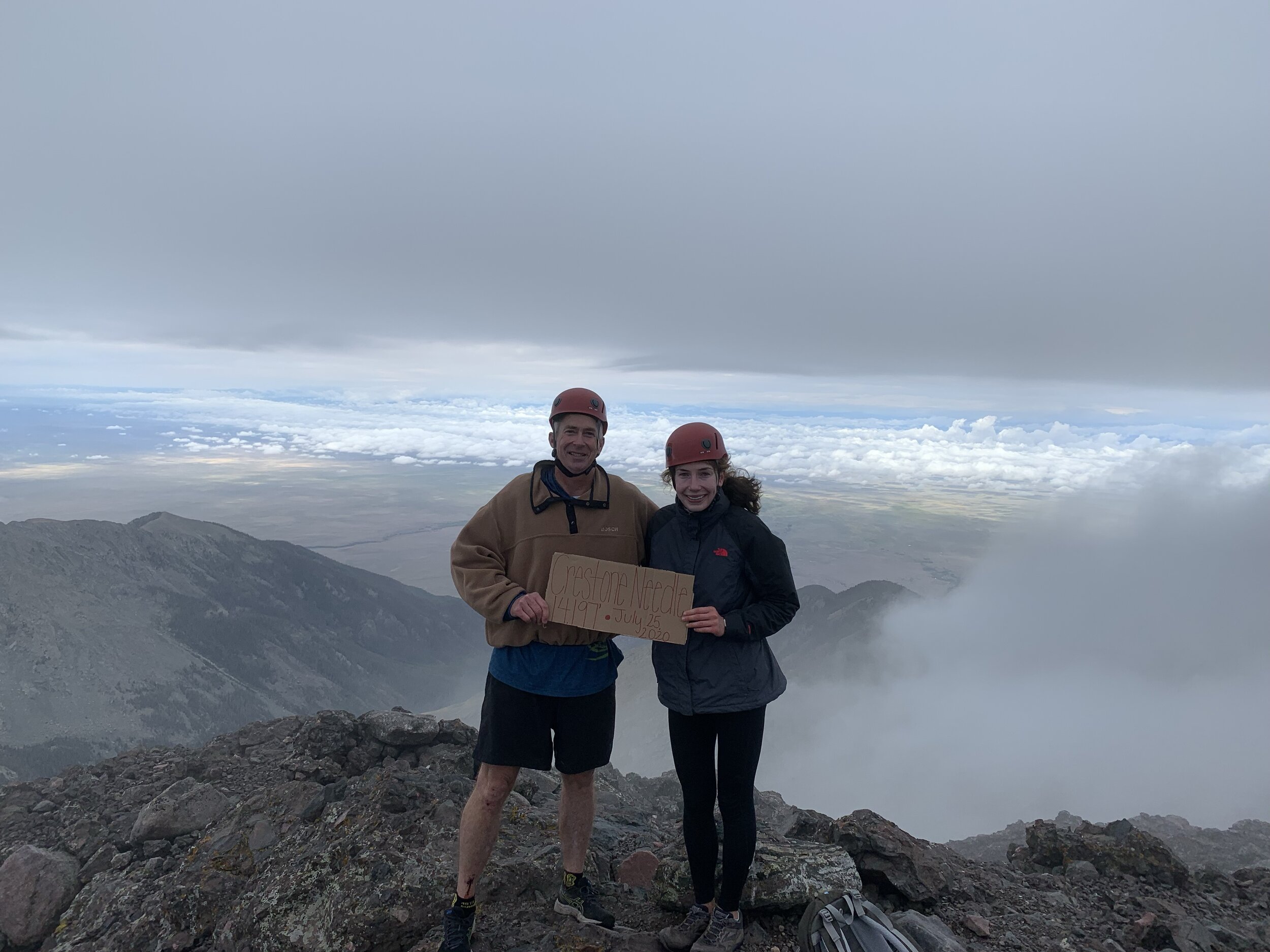
Crestone Needle
July 25, 2020 / 14,197’
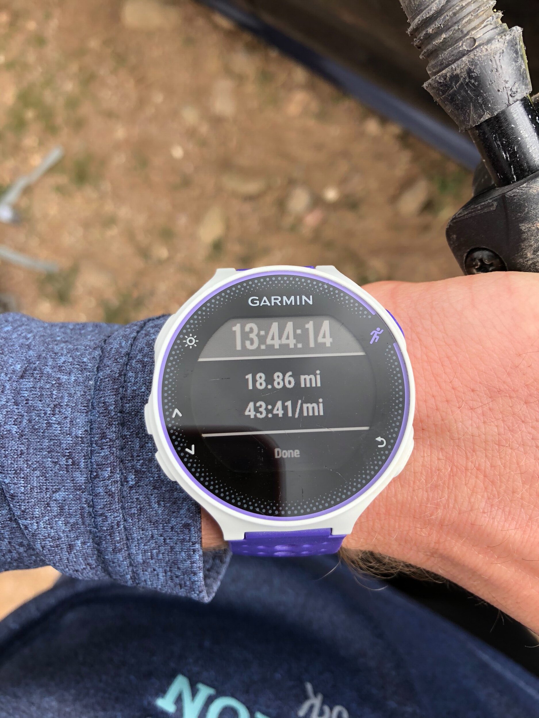
RT STATS: TOTAL TIME - 13 HR & 44 MIN, 18.86 MILES, AND 5,610’ ELEVATION GAIN
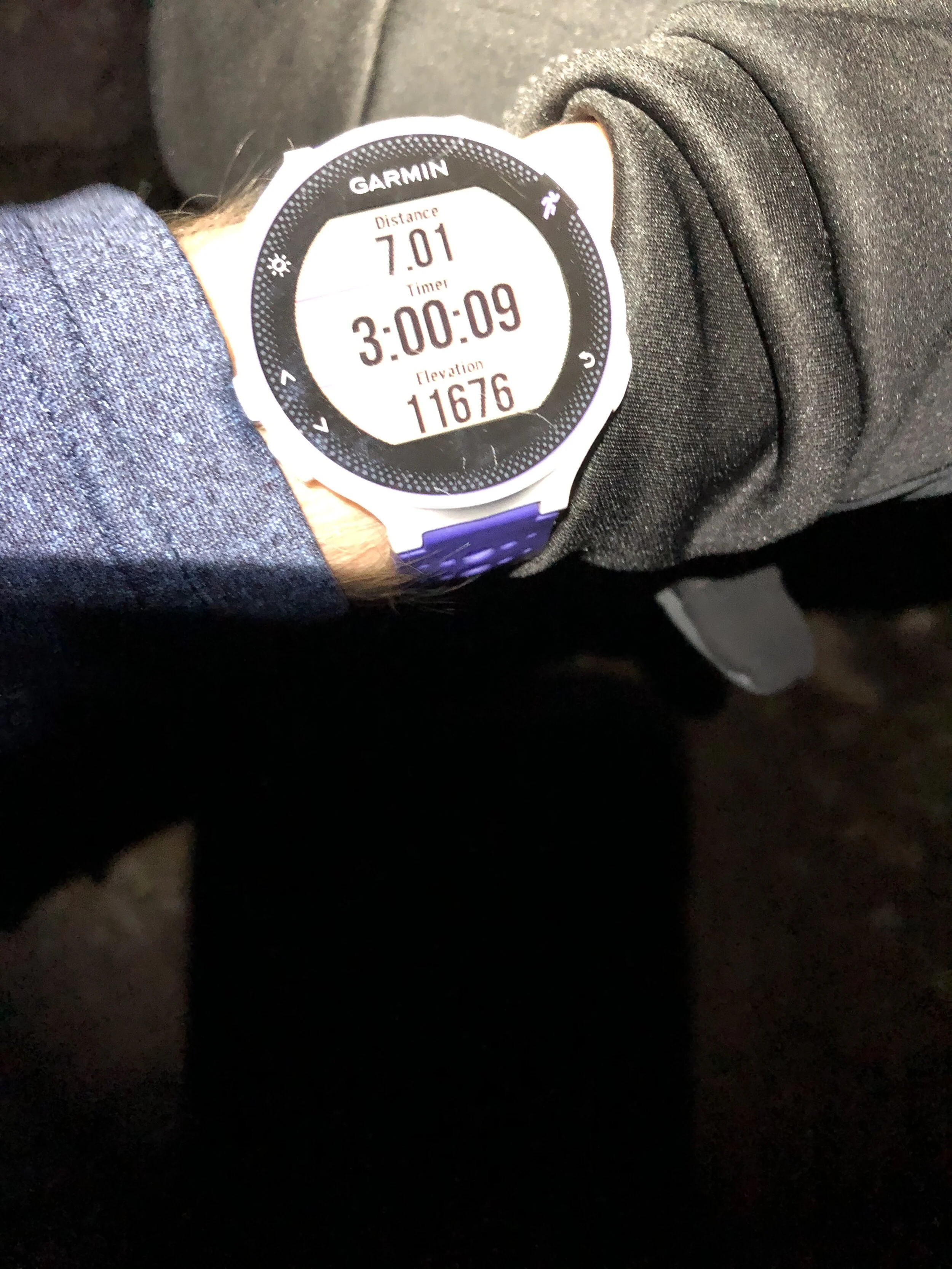
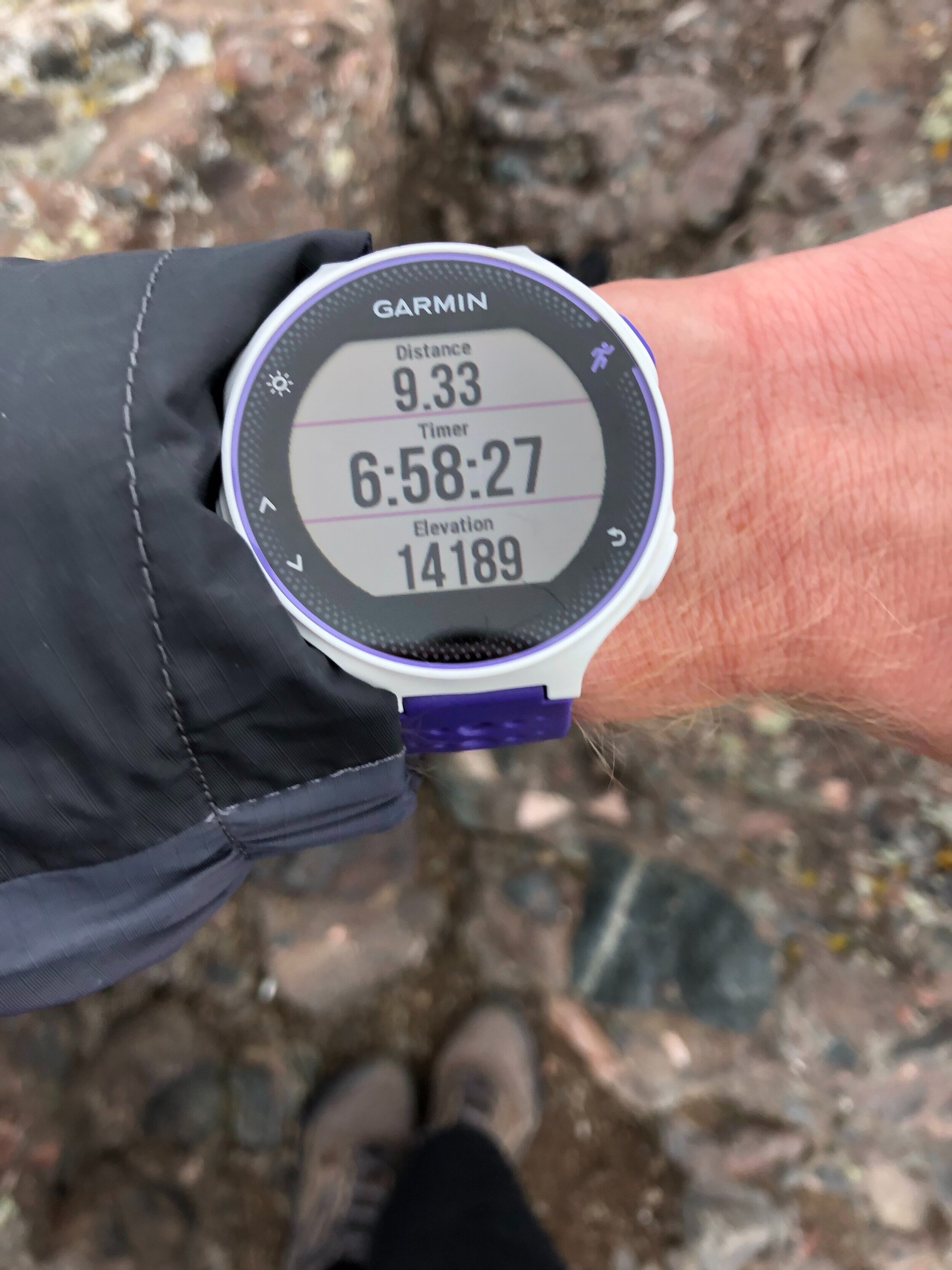
TIME STATS: 6 HR & 58 MIN HR TO SUMMIT, 15 MIN AT SUMMIT, 6 HR & 31 MIN BACK TO TH
RATING (HOW MUCH I LIKED THE HIKE): 9/10
Crestone Needle was definitely an incredible (and very long) day! It was my first time doing an actual Class 4 route and most people consider it in the top 8 most difficult Colorado 14ers (out of the 58)!! It was definitely a little shocking look back at the Needle on the descent and realizing that I was up there a few hours earlier :). This is my most technical peak to date and it gives me a lot more confidence in my (eventually, maybe 2021?) goal of finishing all 58 14ers. There are 22 left now.
I hiked the Needle with my dad. My dad hiked the Needle all the way back in 2002, but from the Cottonwood Creek TH. I barely slept the night of (lol EMPHASIS ON OF, NOT BEFORE) this hike—I woke up at midnight. The South Colony Lakes TH (2WD) near Westcliffe is less than 2 hours away from the Springs so we got there a little after 2am. This was by far the earliest I had ever started a hike. We started the hike this early because it is the monsoon season in CO right now and the weather forecast was not looking good at all for the afternoon (but weather can be so unpredictable that a sunny day turns chaotic…).
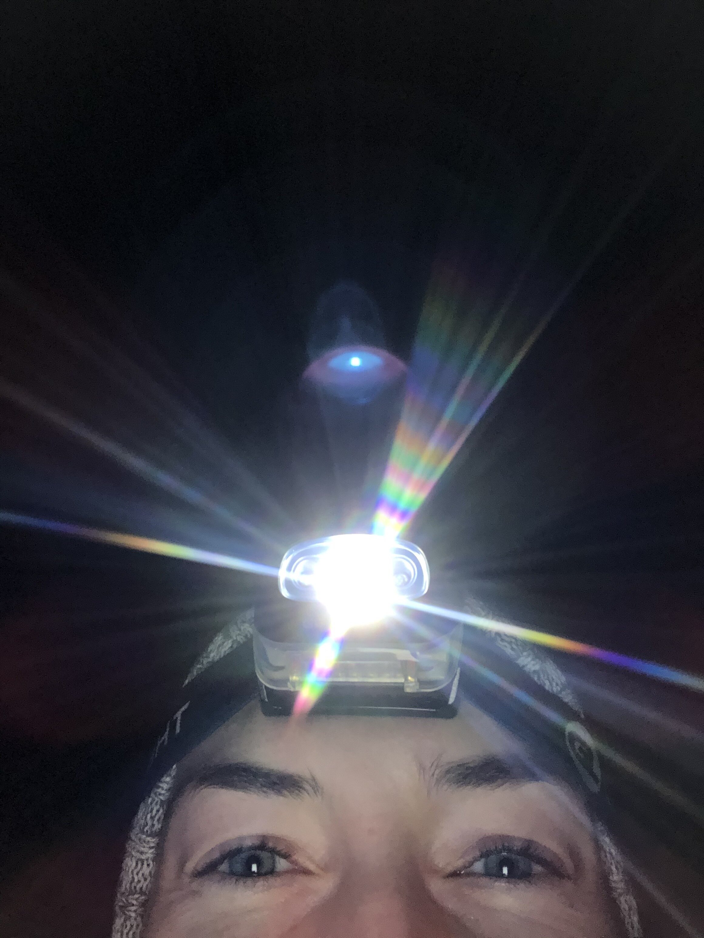
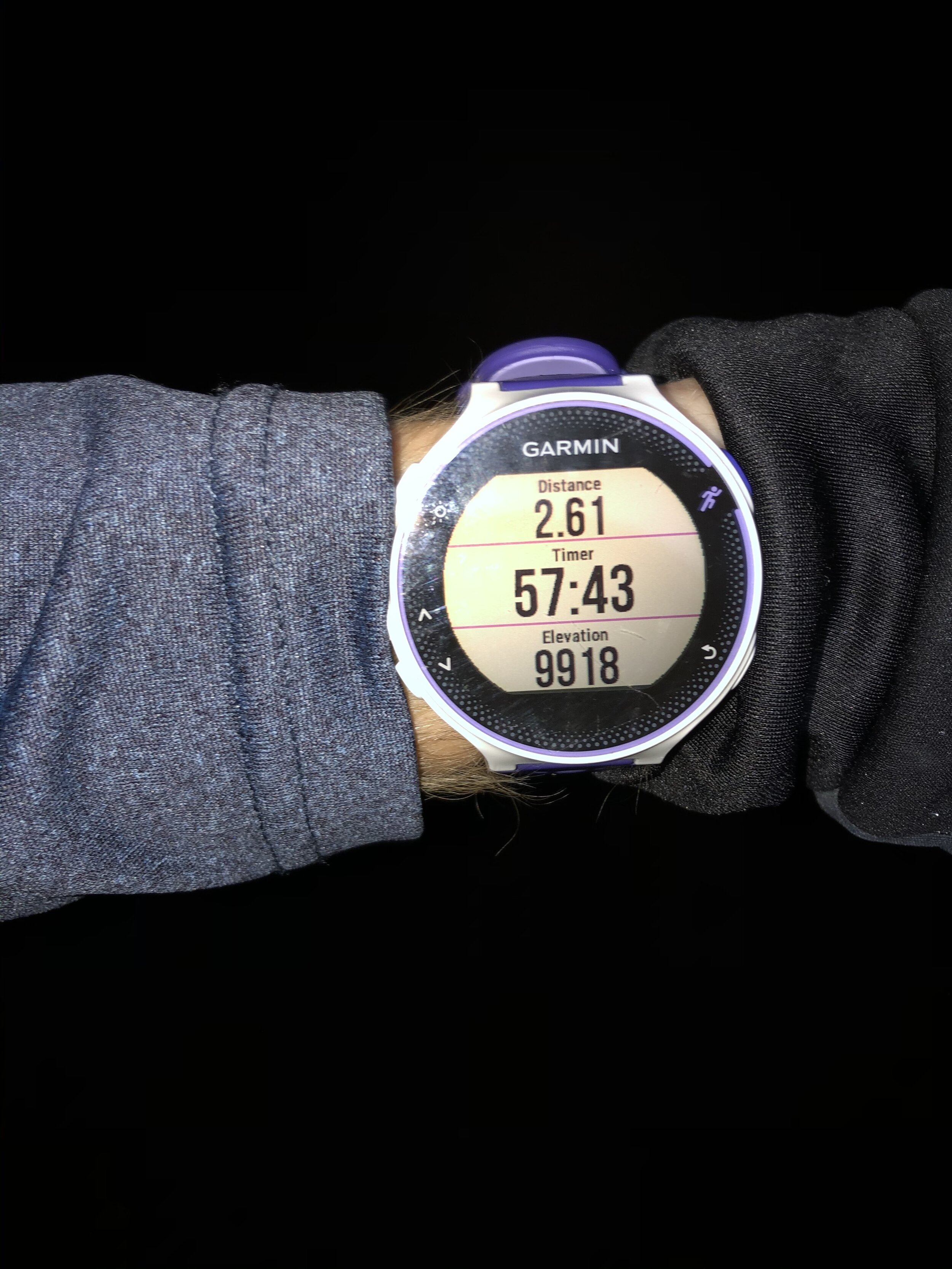
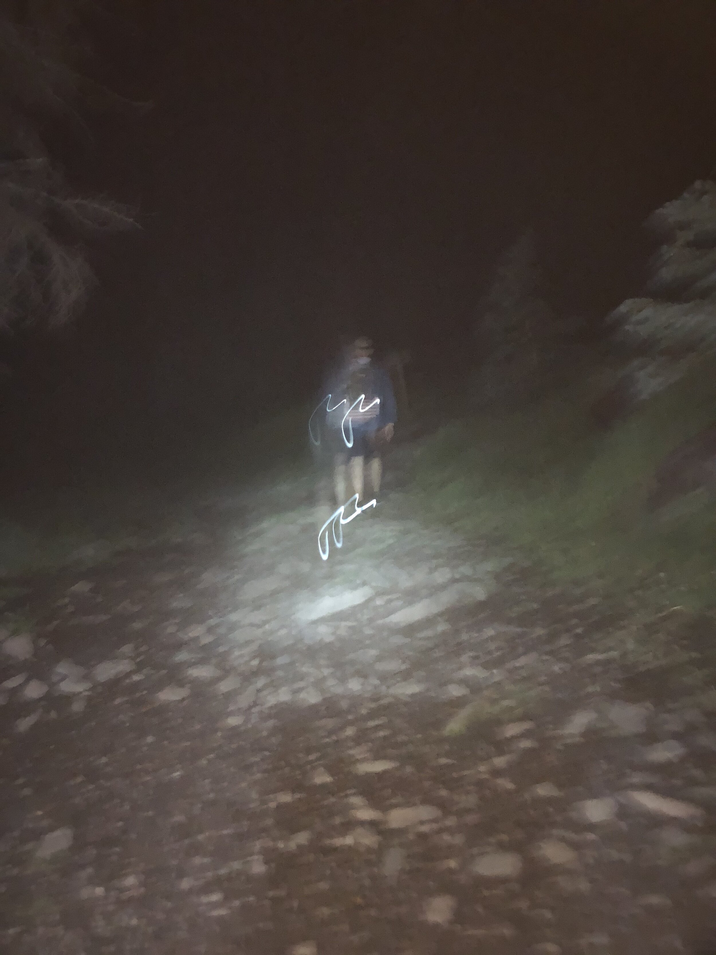
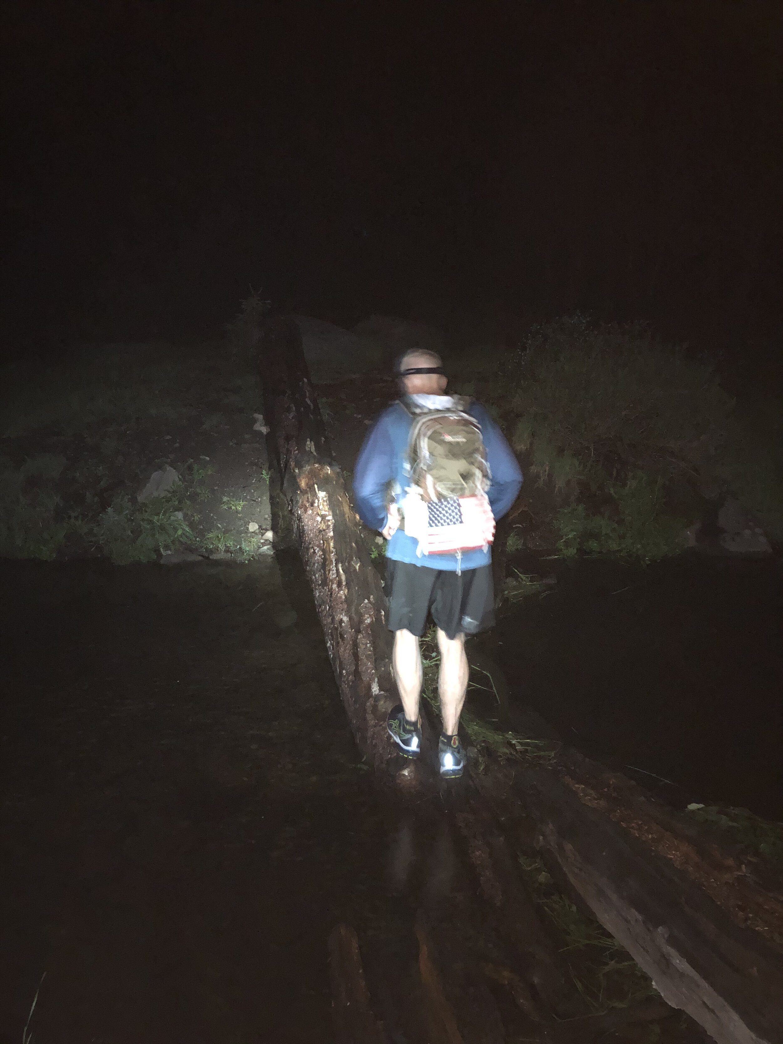
We started the hike at 2:20 am from the 2WD TH (elevation ~8,800’). I took a kristin selfie with my cool headlamp ;). I didn't take many pictures until it got light out because it was pitch black. The pictures I did take were kinda spooky as you can see in the 3rd picture below haha. We reached the 4WD TH at 2.6 miles/58 minutes in. At just over 2 hours and 5.2 miles in, we reached the trail junction. We went to the left for the Needle route. A month earlier, I hiked Humboldt with my sister and we went to the right at this junction.
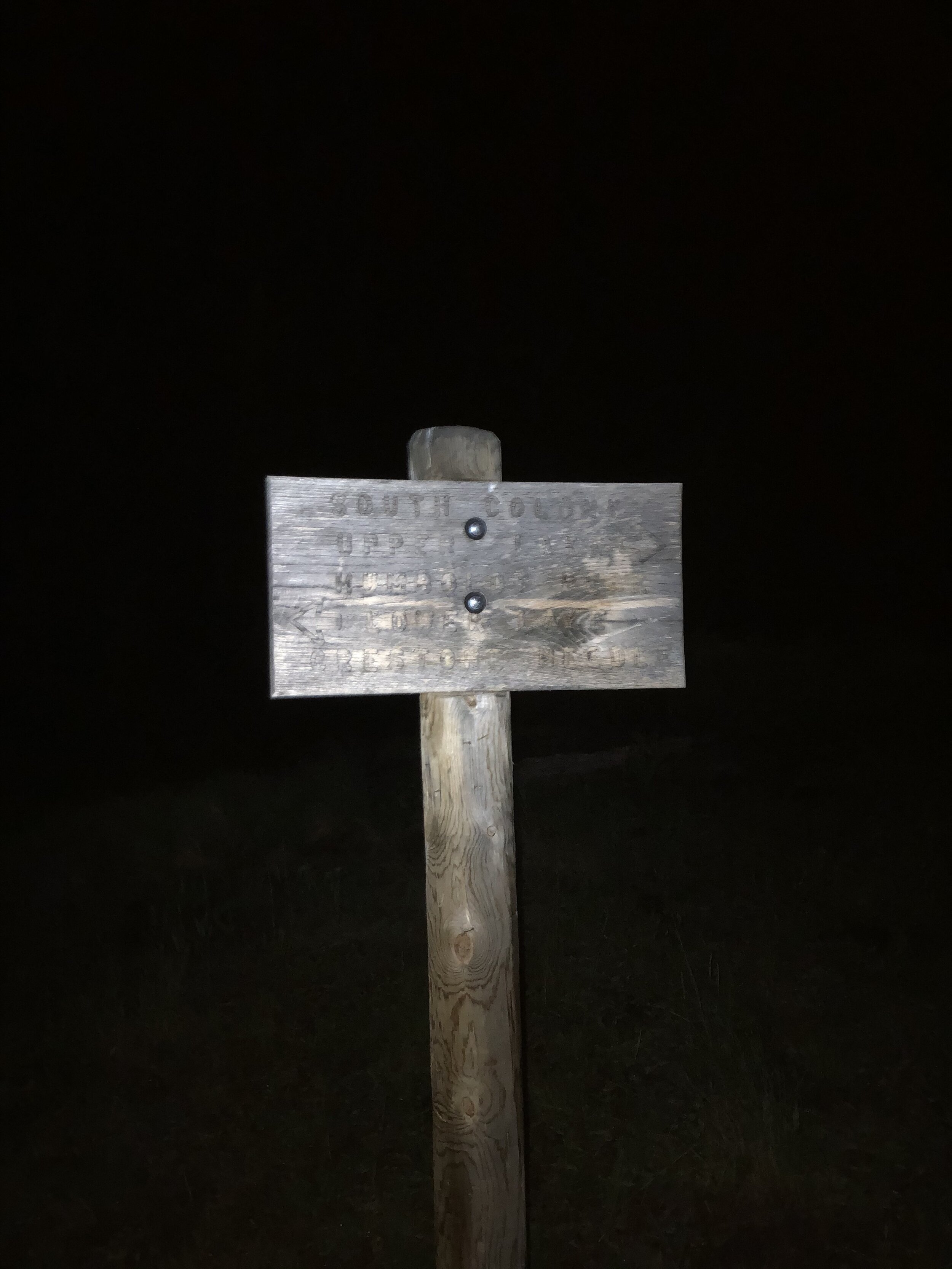
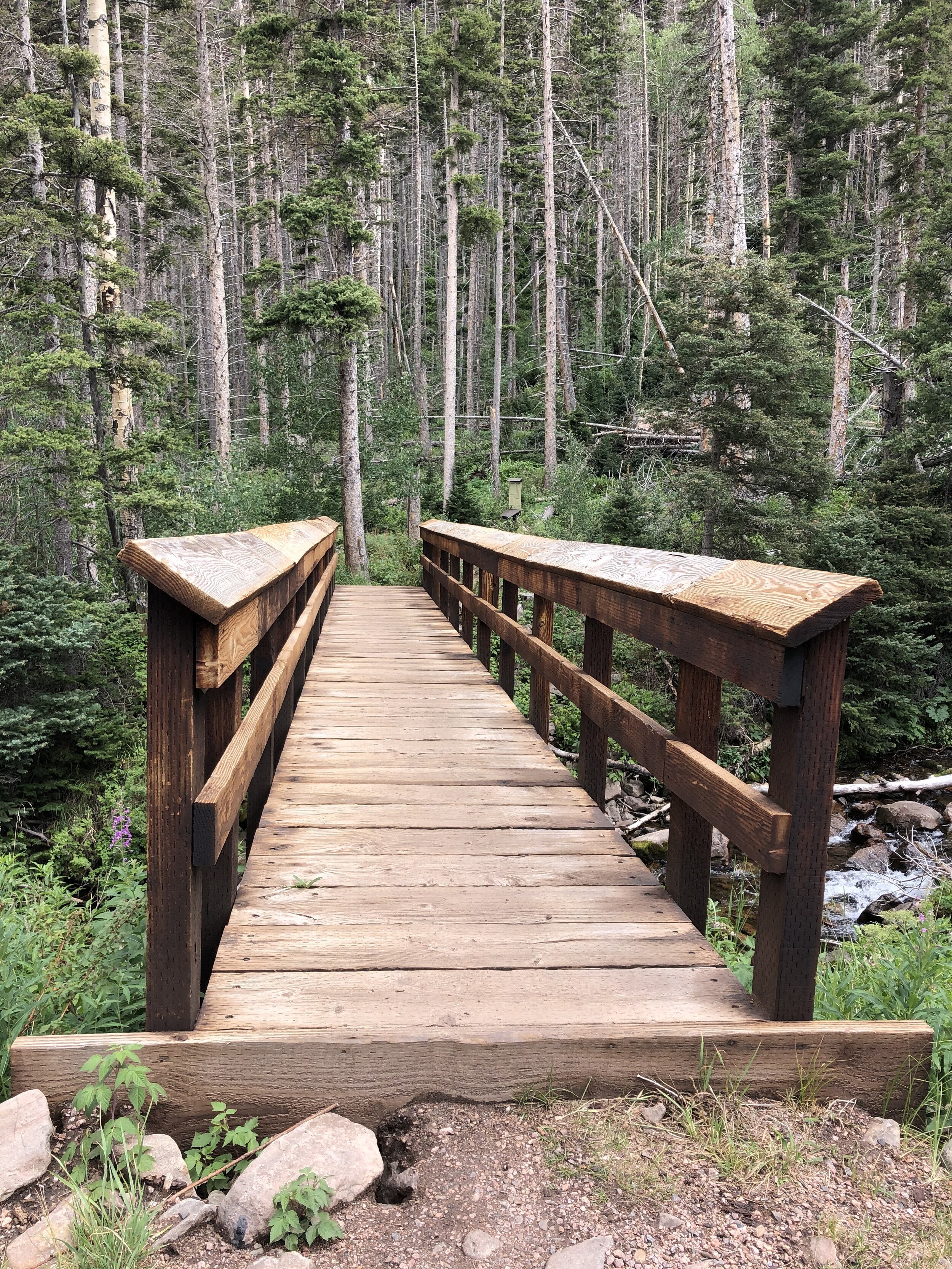
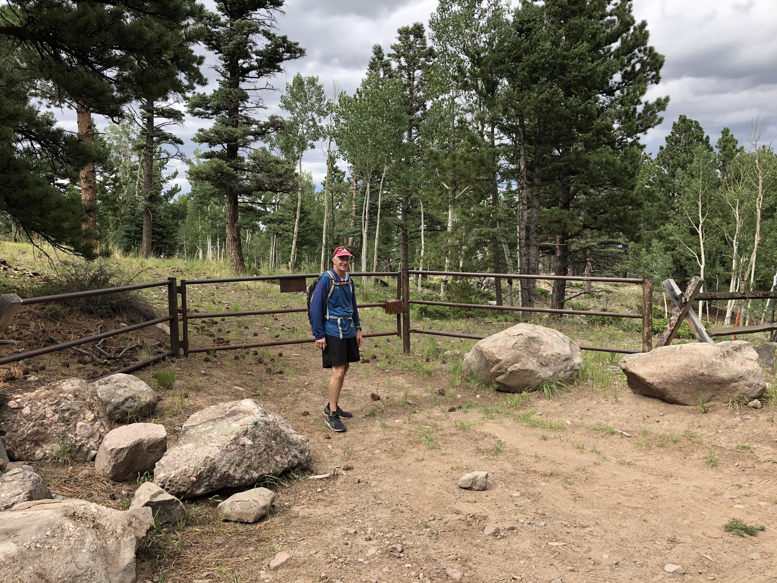
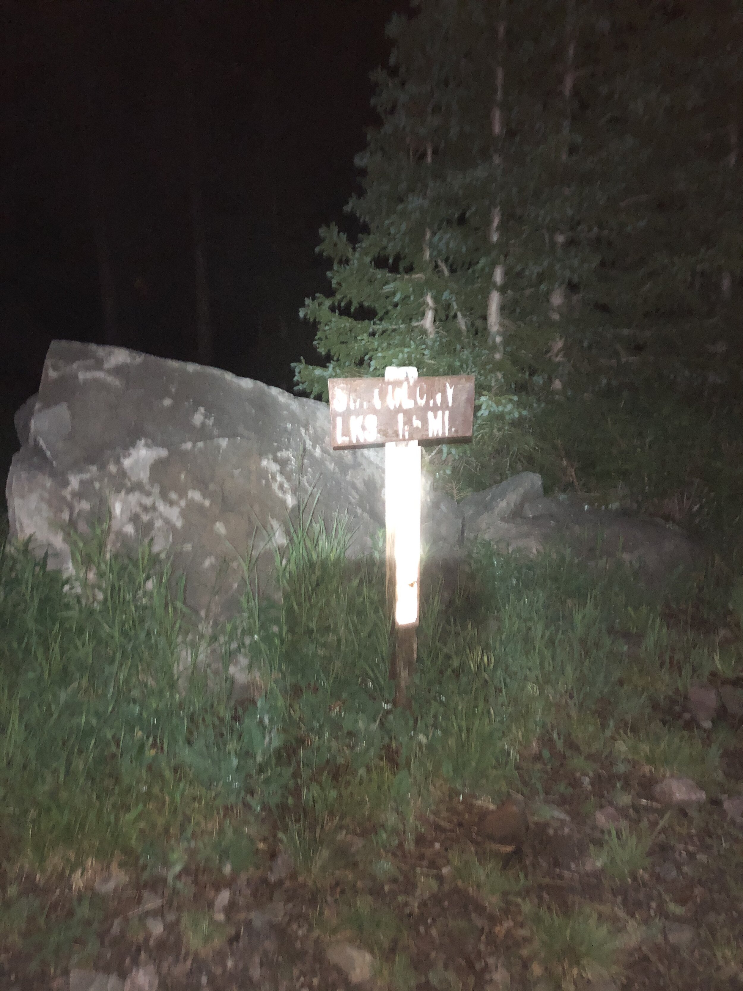
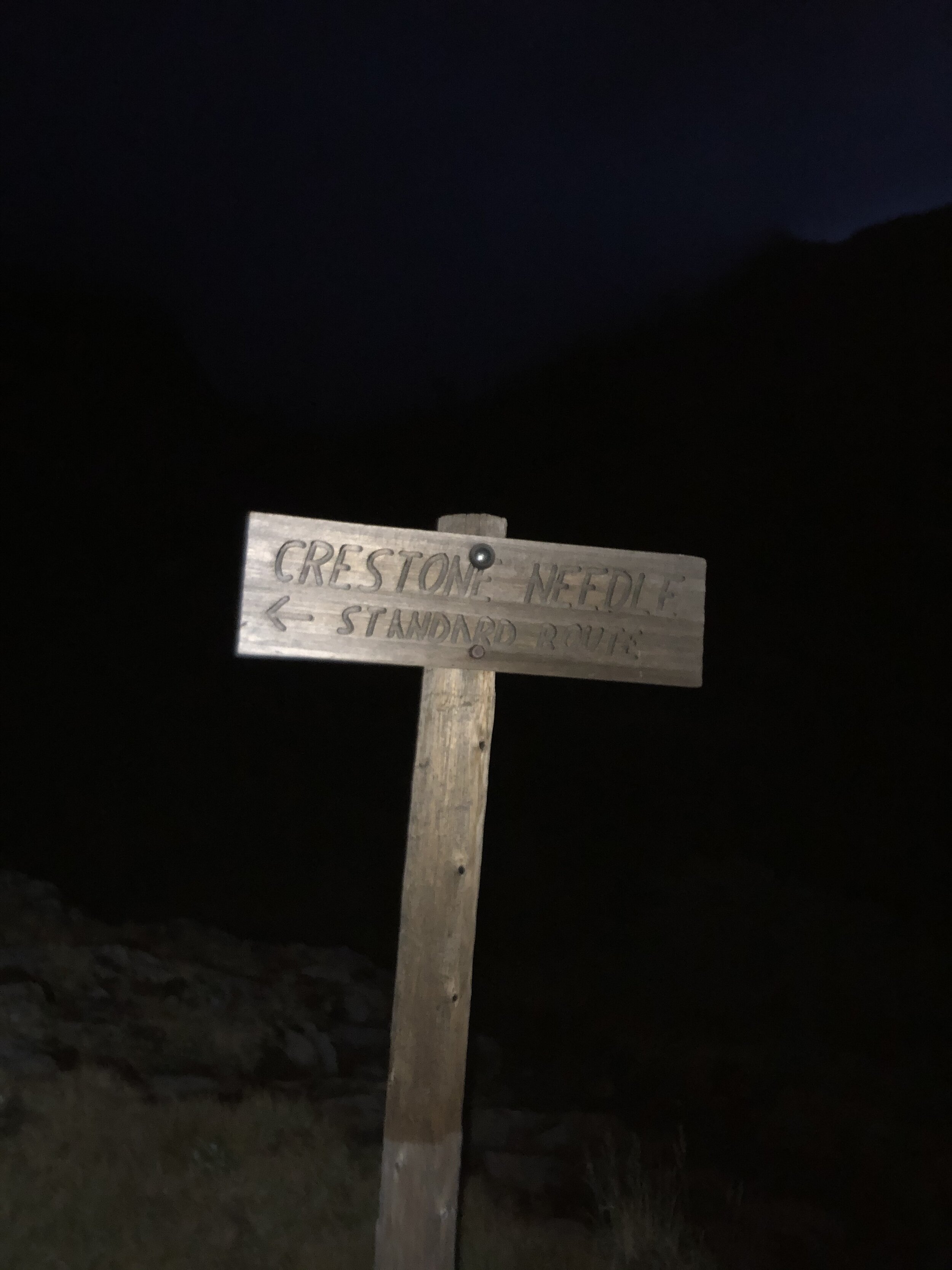
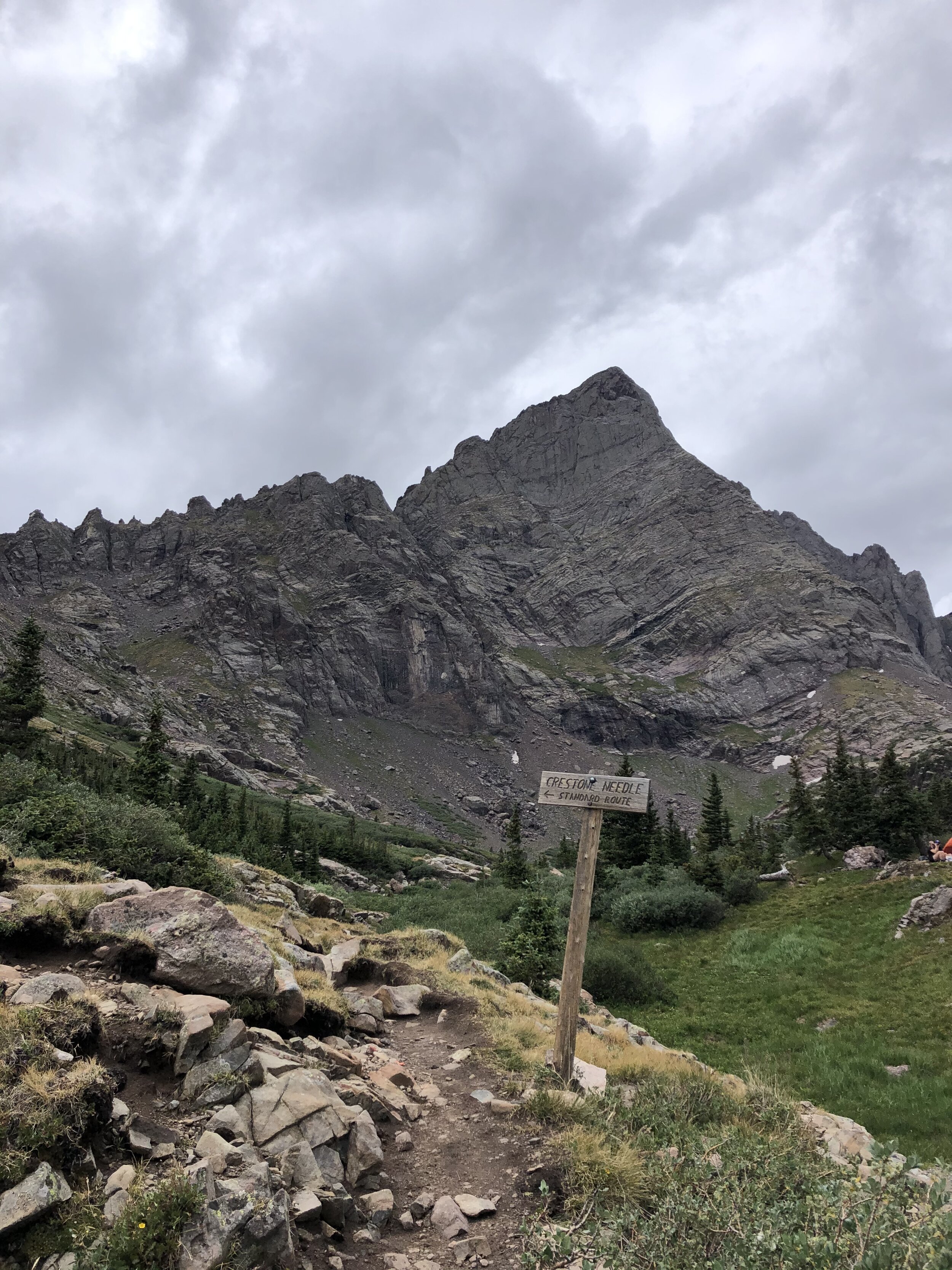
Just after turning left on this junction, we crossed a log bridge. Shortly after, we passed through a gate. 3 hours/7 miles in, we reached a trail junction around 11,700’ pointing us towards the Crestone Needle Standard Route.
Around 5:30 am, the sunrise was starting to become evident. I had my dad snap some cool pictures of me with the sunrise in the background!
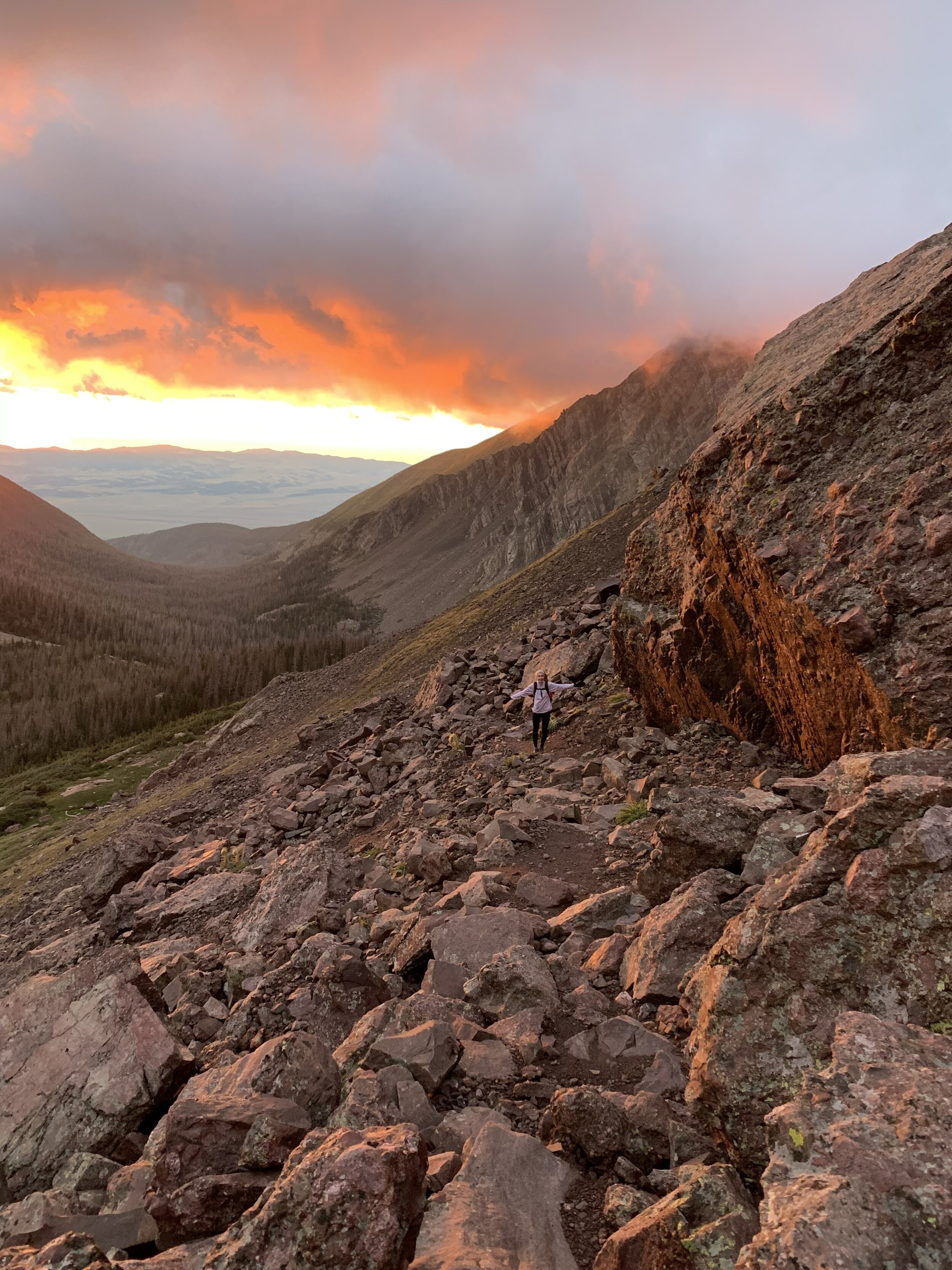
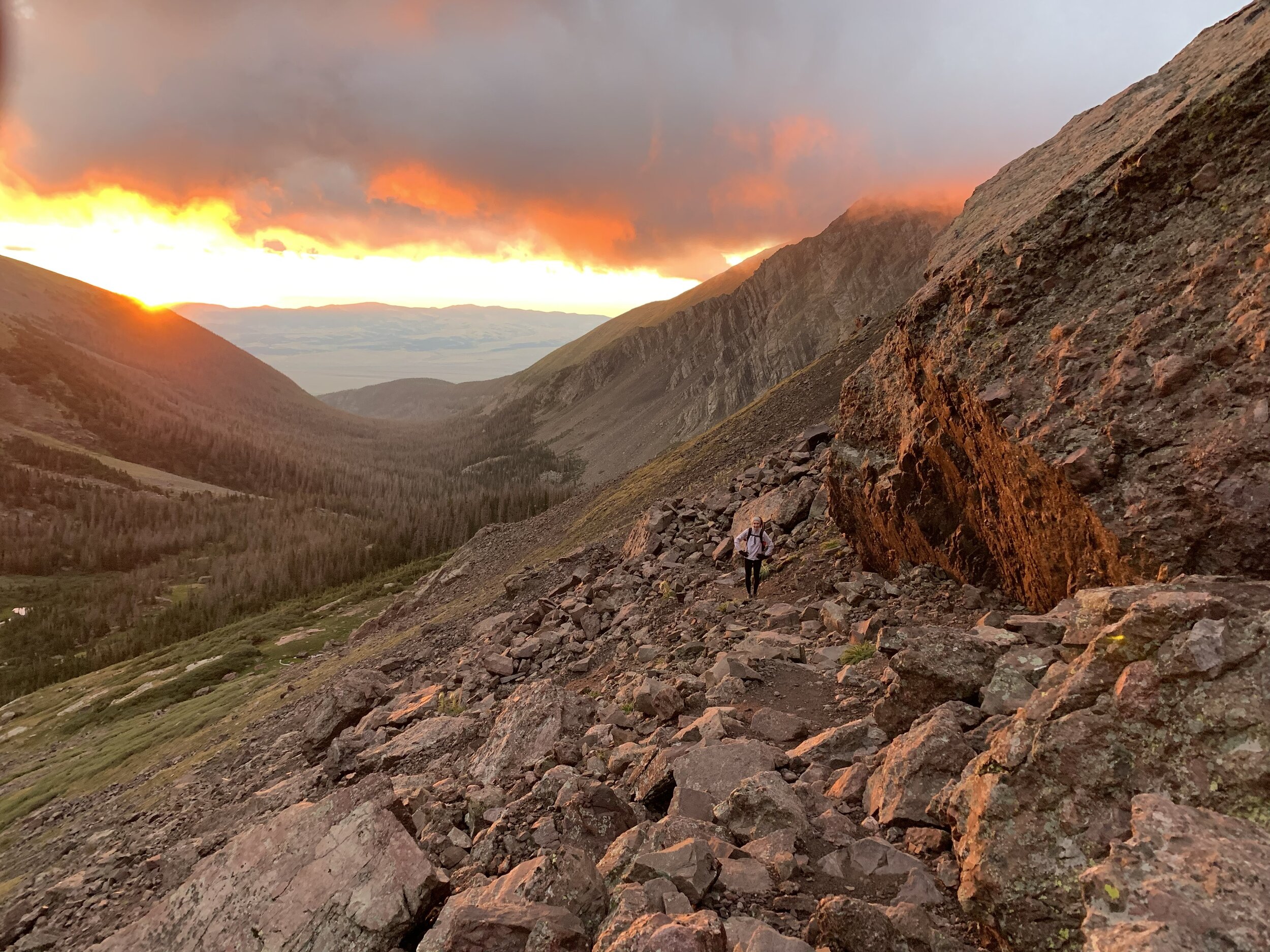
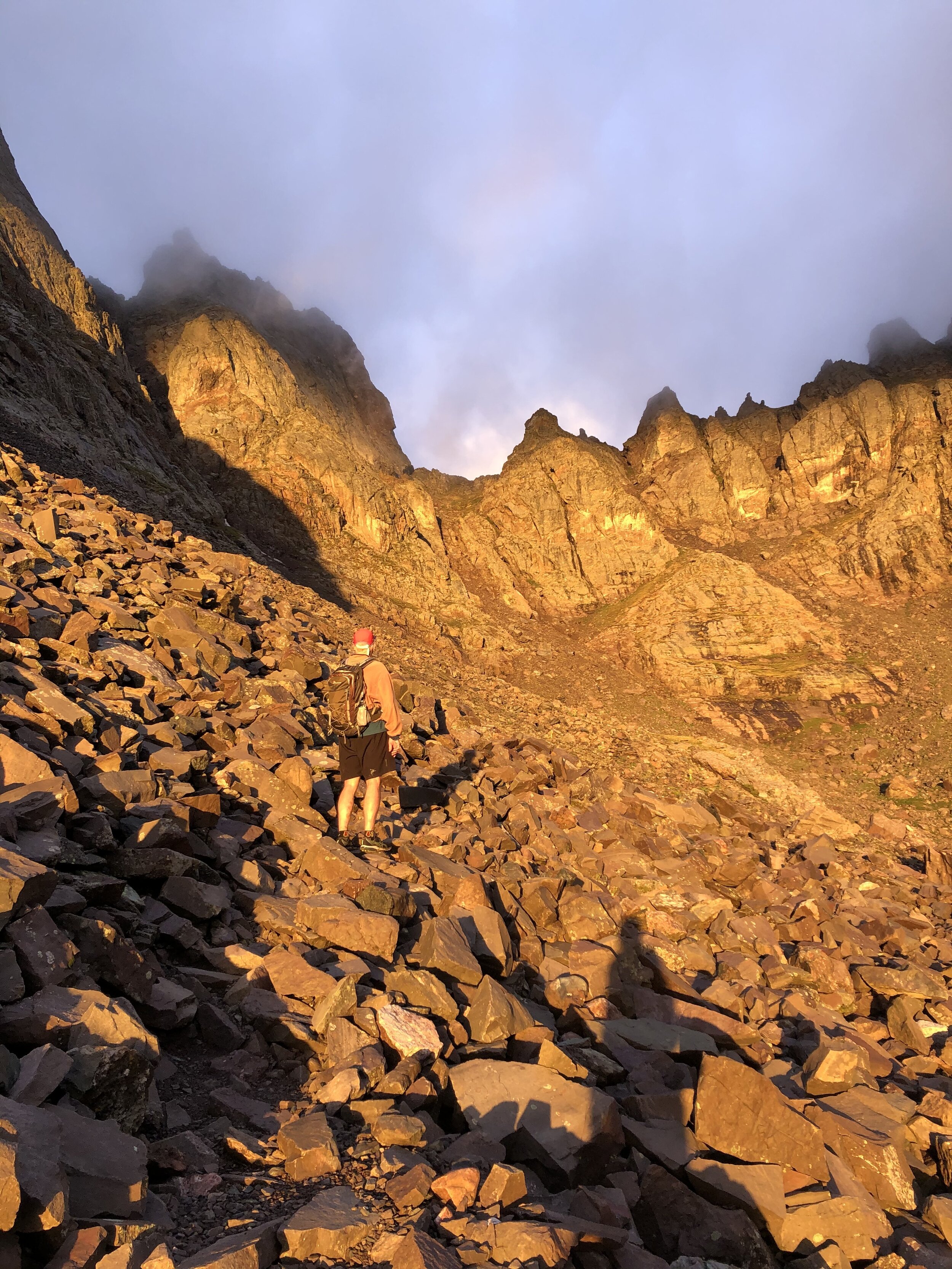
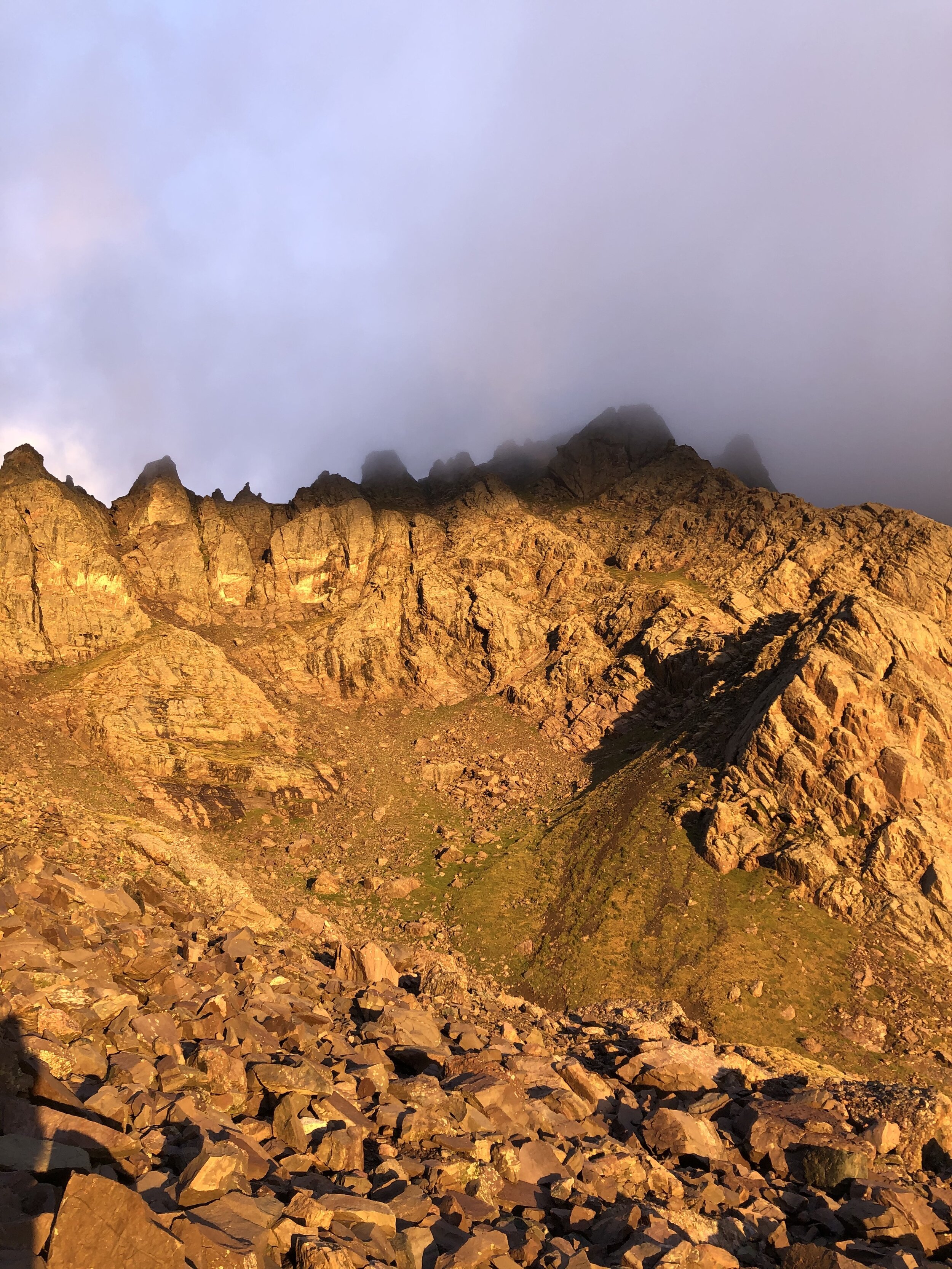
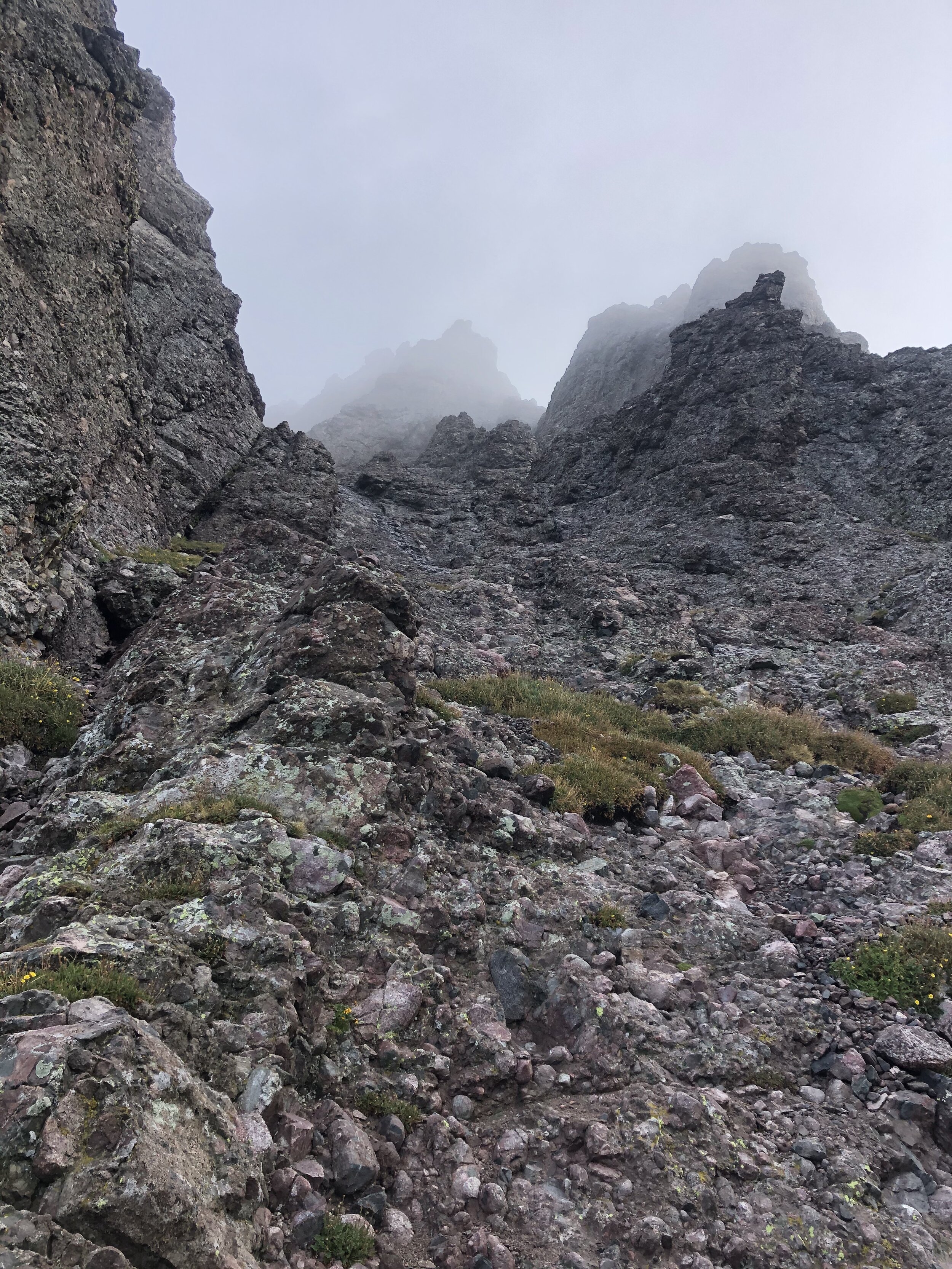
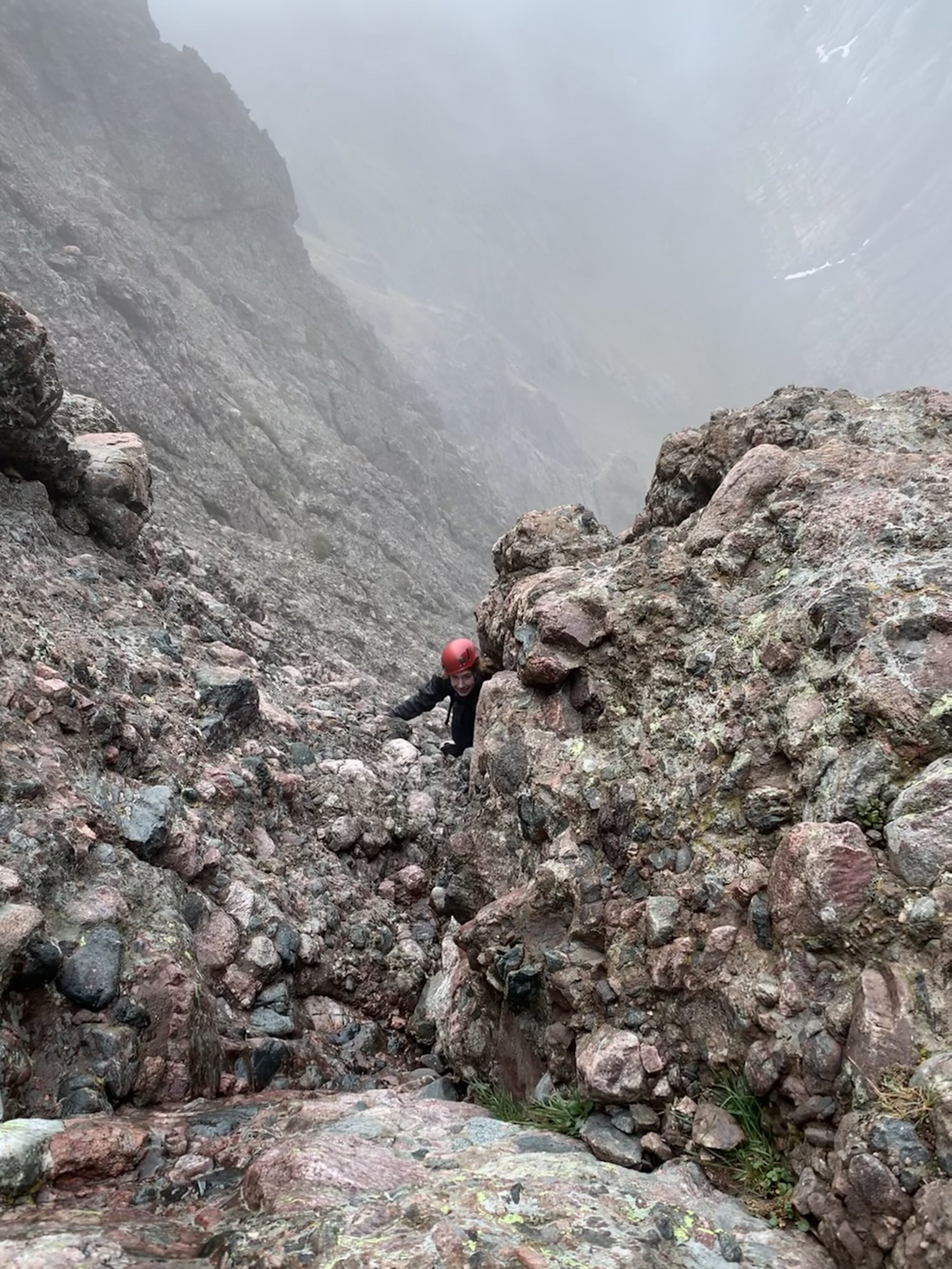
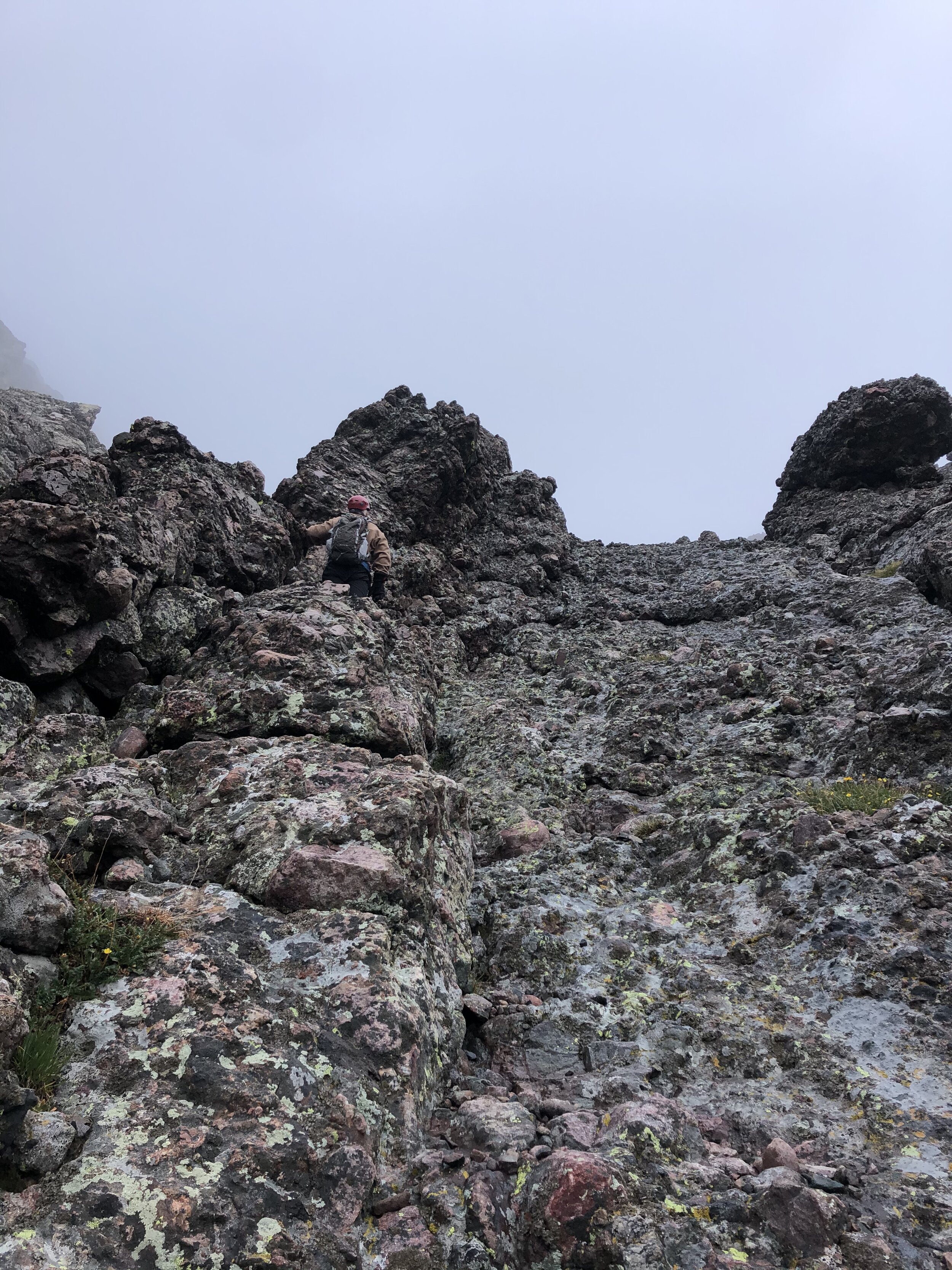
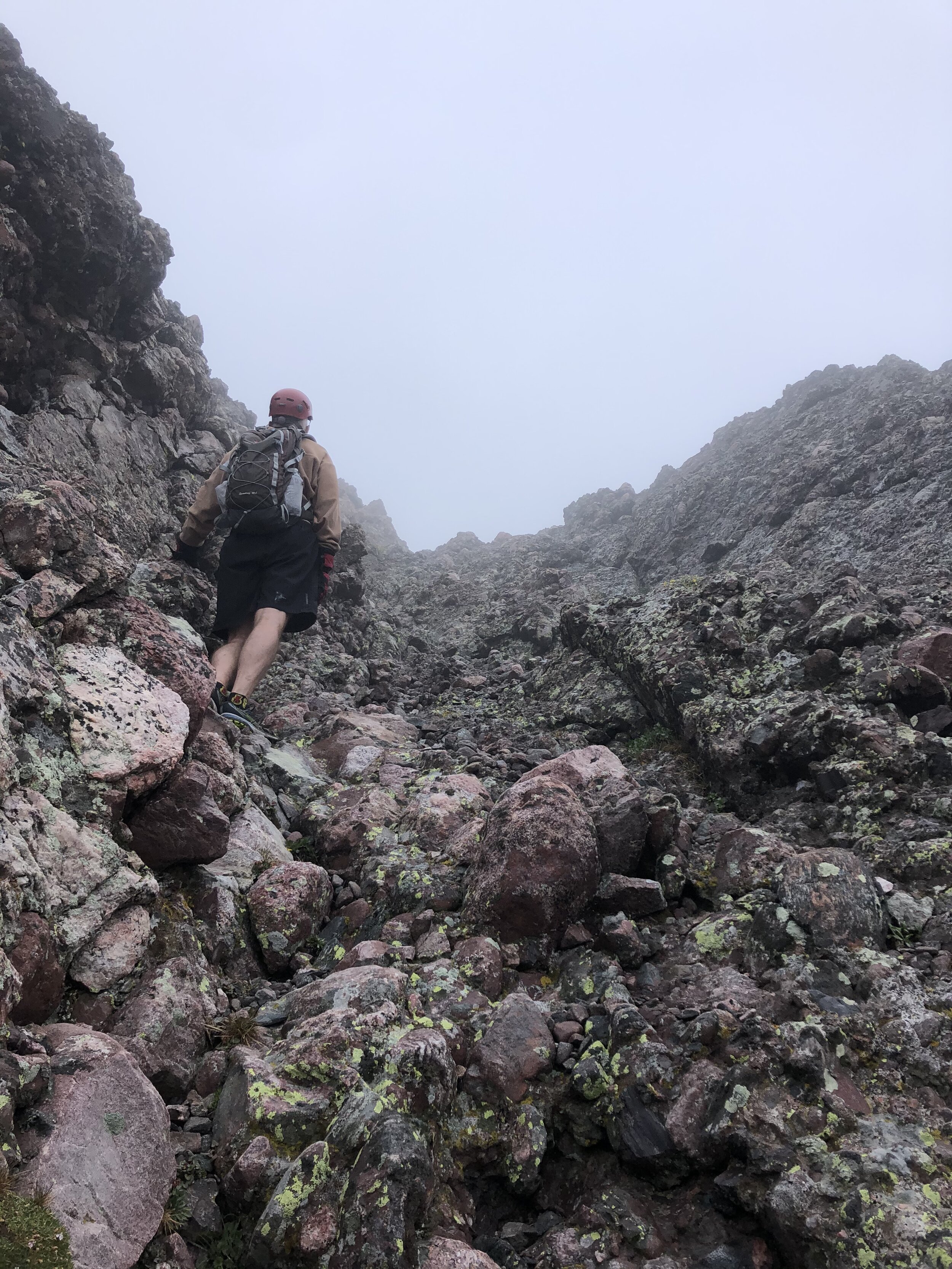
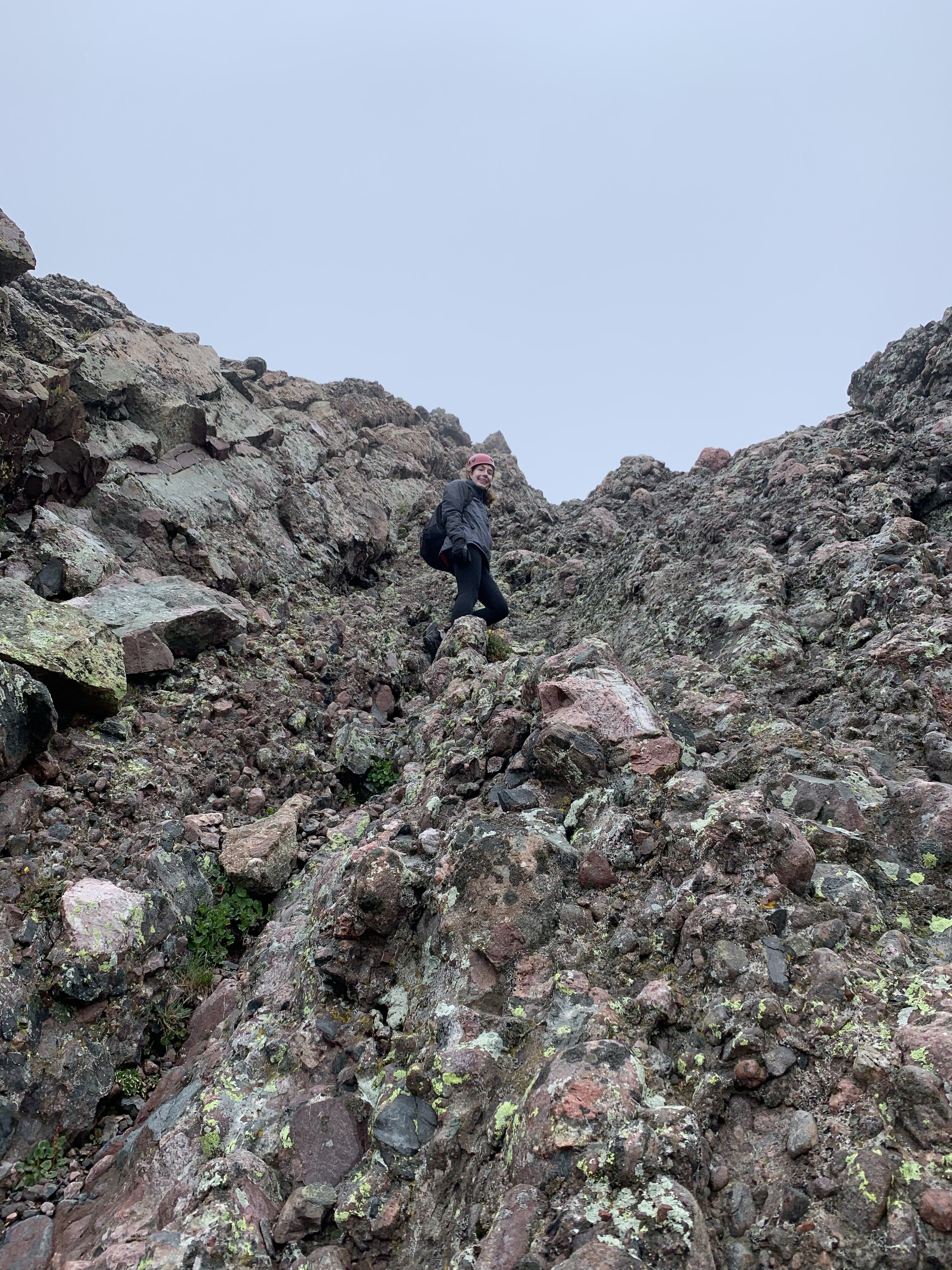
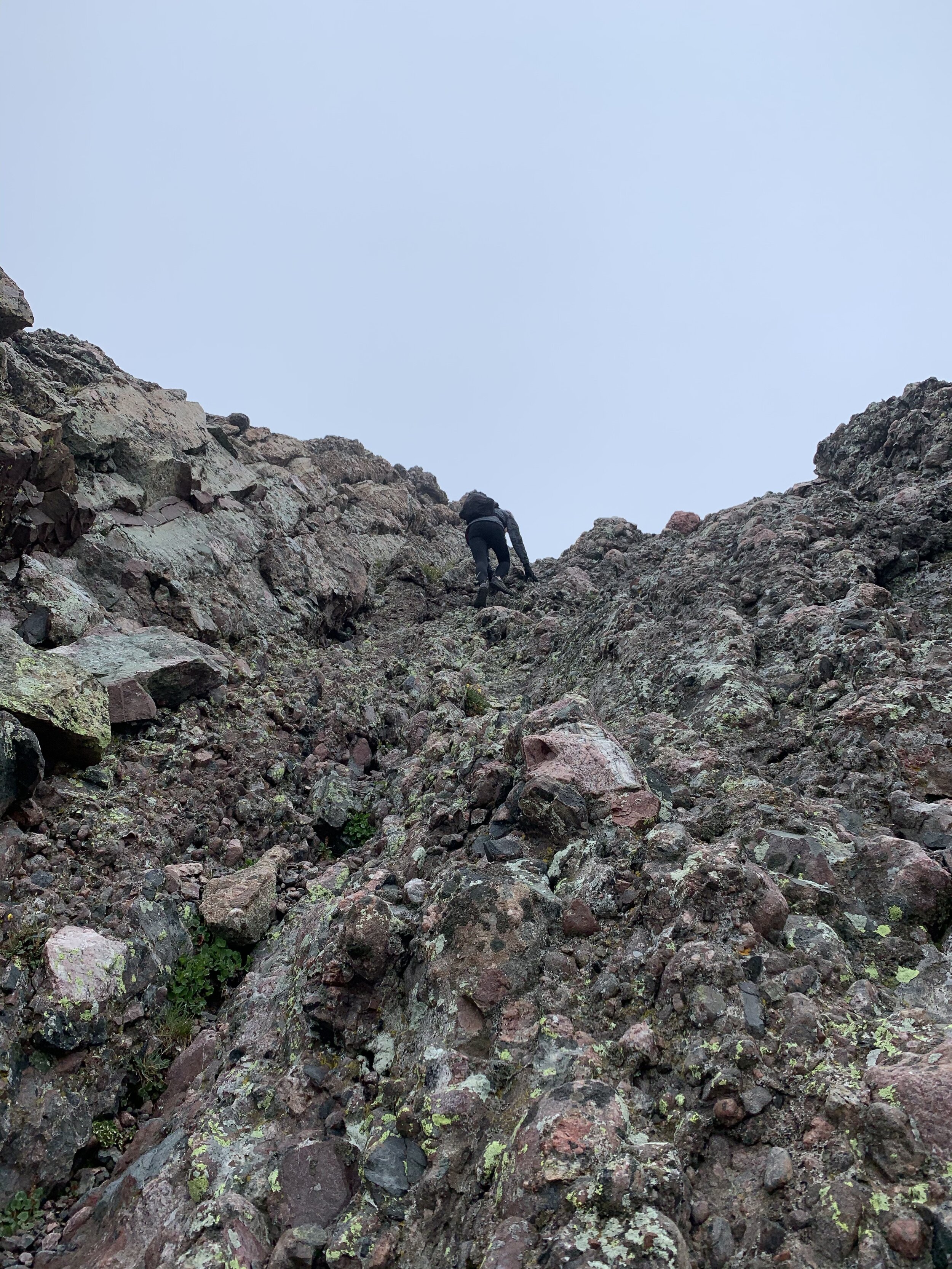
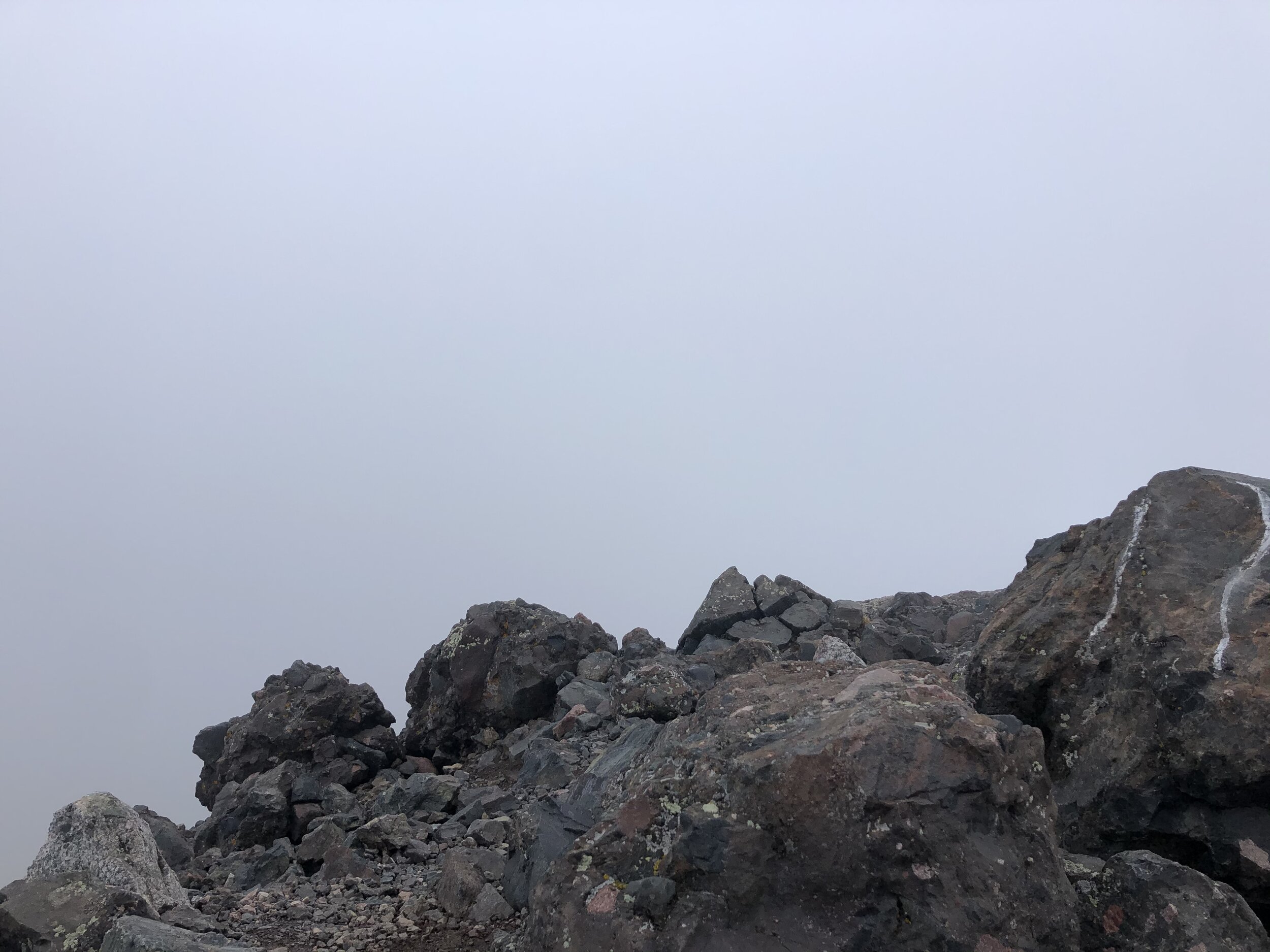
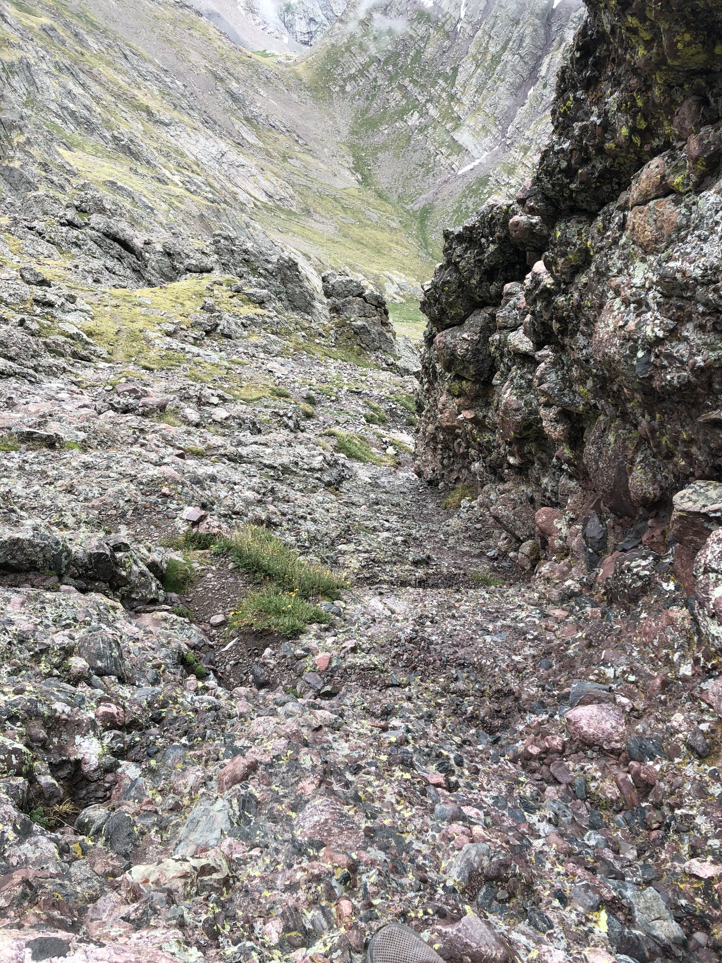
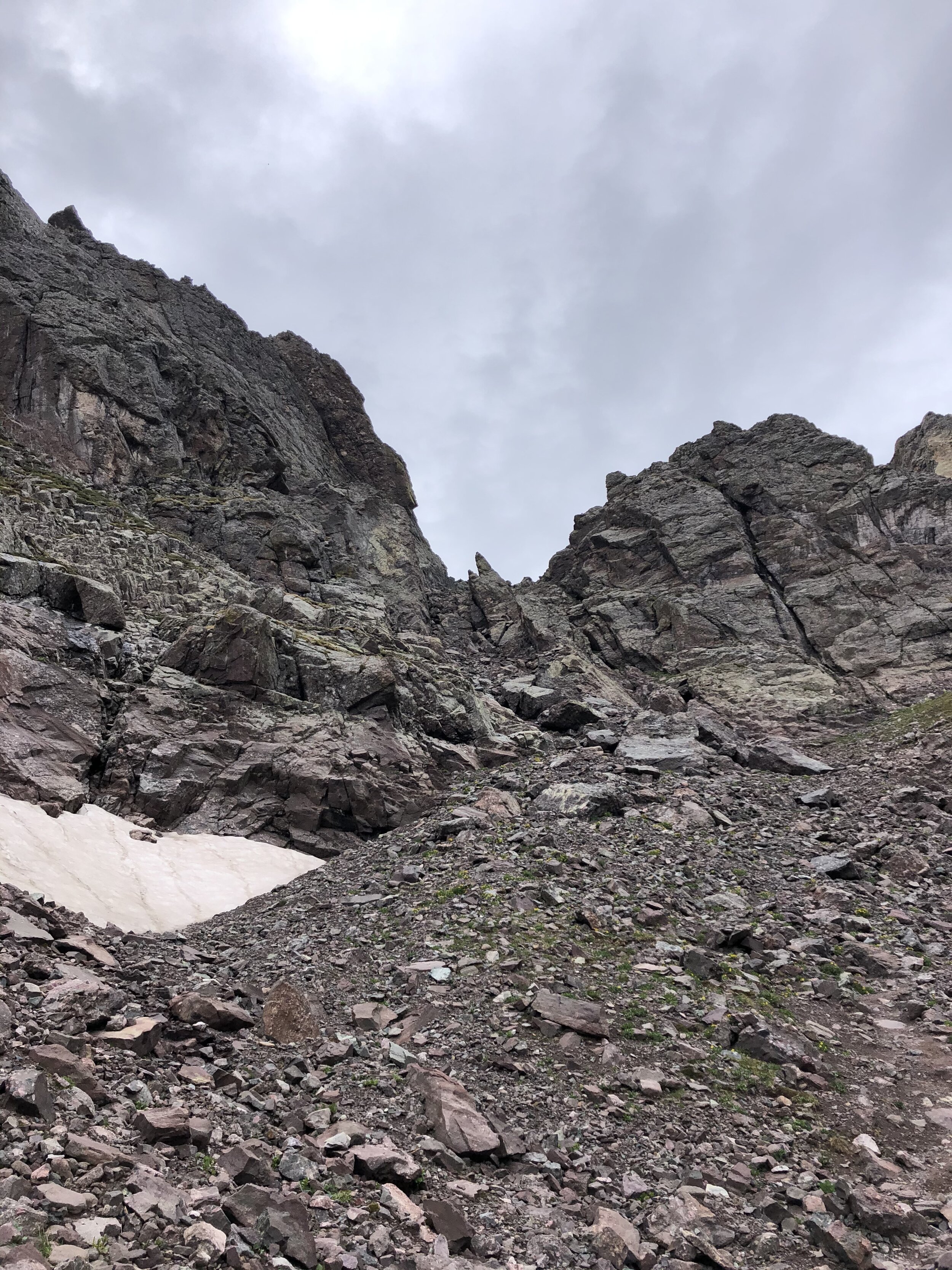
We ascended some Class 3 stuff going up to Broken Hand Pass. We reached Broken Hand Pass (elevation 12,850’) at just after 6:30 am. There was a defined trail for the next few hundred feet of gain. Right around 13,300’, we descended around 50-75’ pitch so that we would reach what is called the “east gully” (Class 4). To keep the climb at Class 3 difficulty, you can switch over to the “west gully” a couple hundred feet up from this point; however, we stayed on the east gully for the ascent and descent. We reached the part where the east gully began about 1 hour after reaching Broken Hand Pass. THE FUN BEGINS HERE WOOOO. As you can see in the rest of the pictures above Broken Hand Pass, it was extremely foggy and was starting to get a tad windy (but NOTHING like Columbia last month thank goodness).
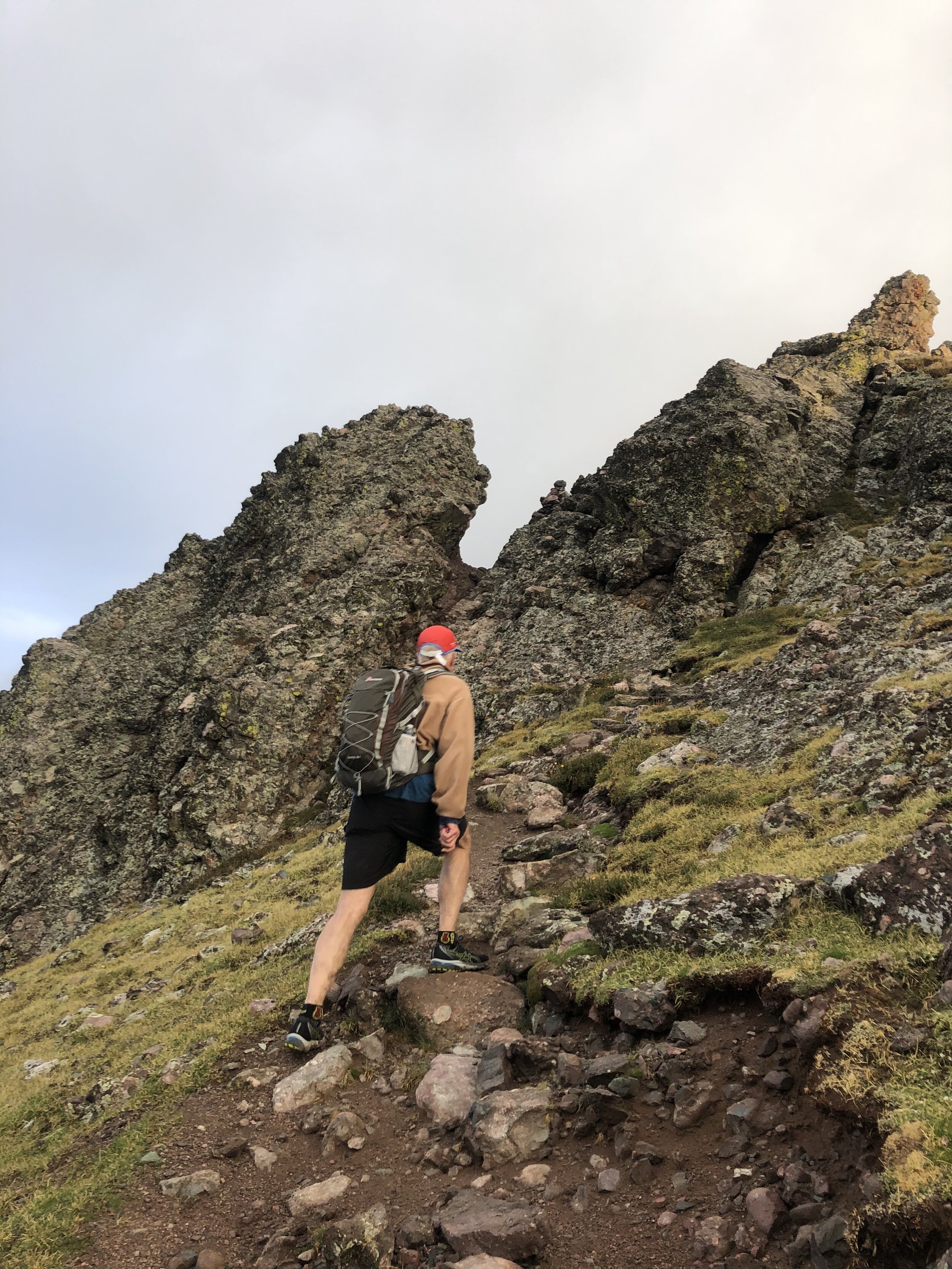
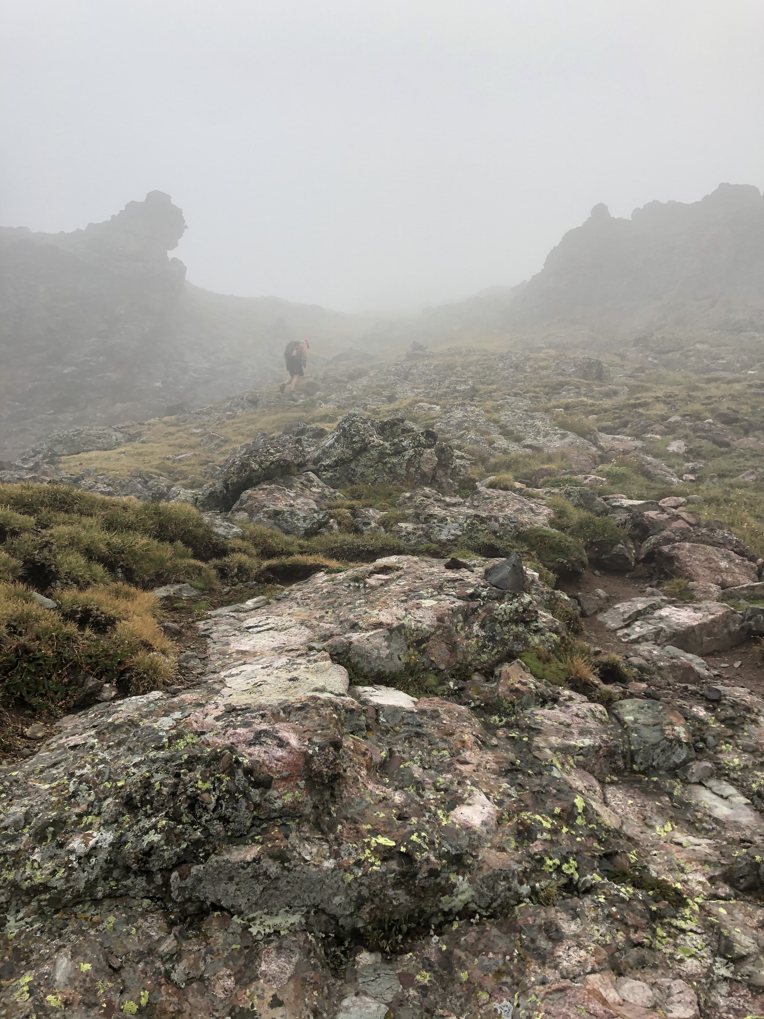
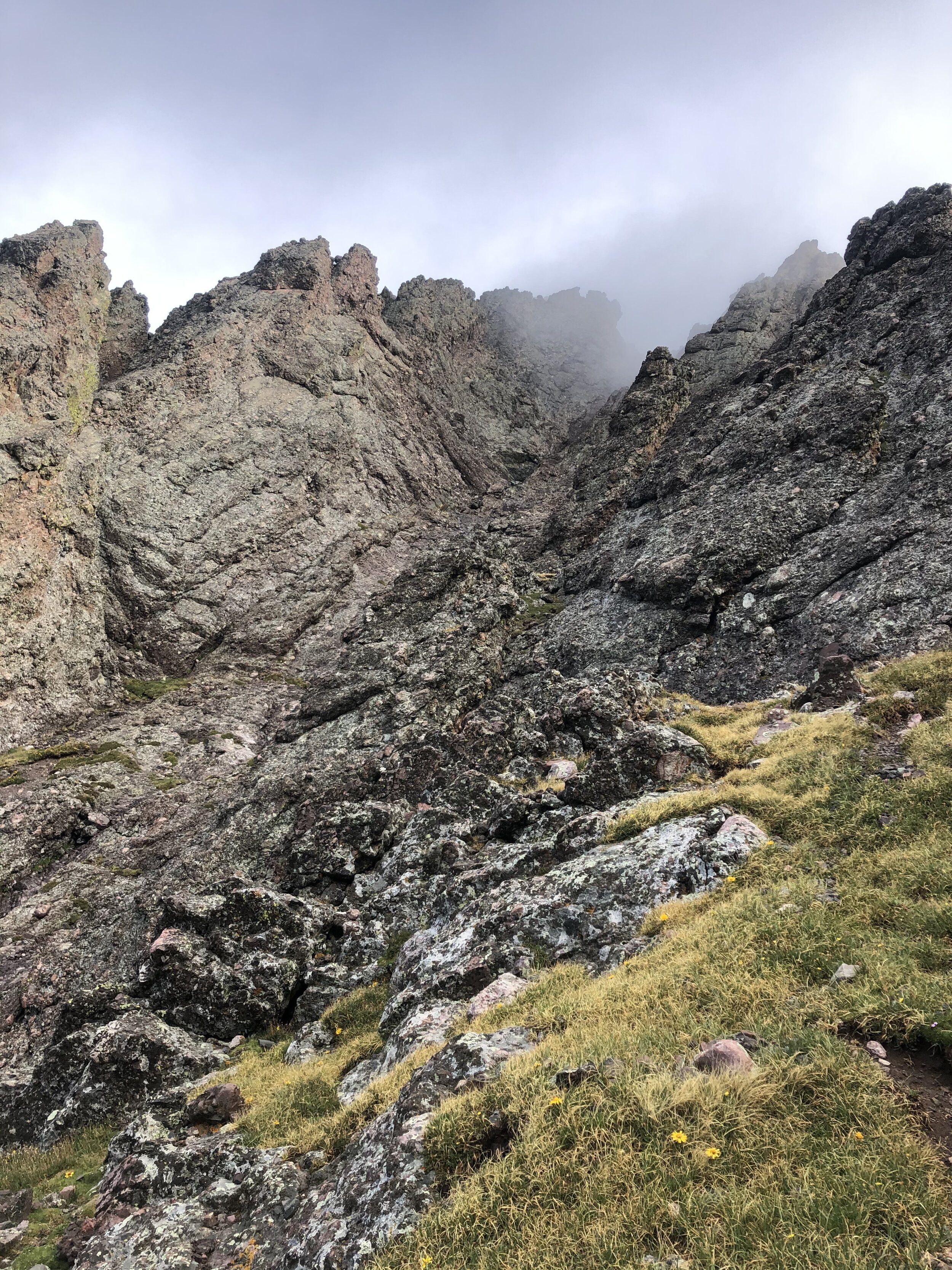
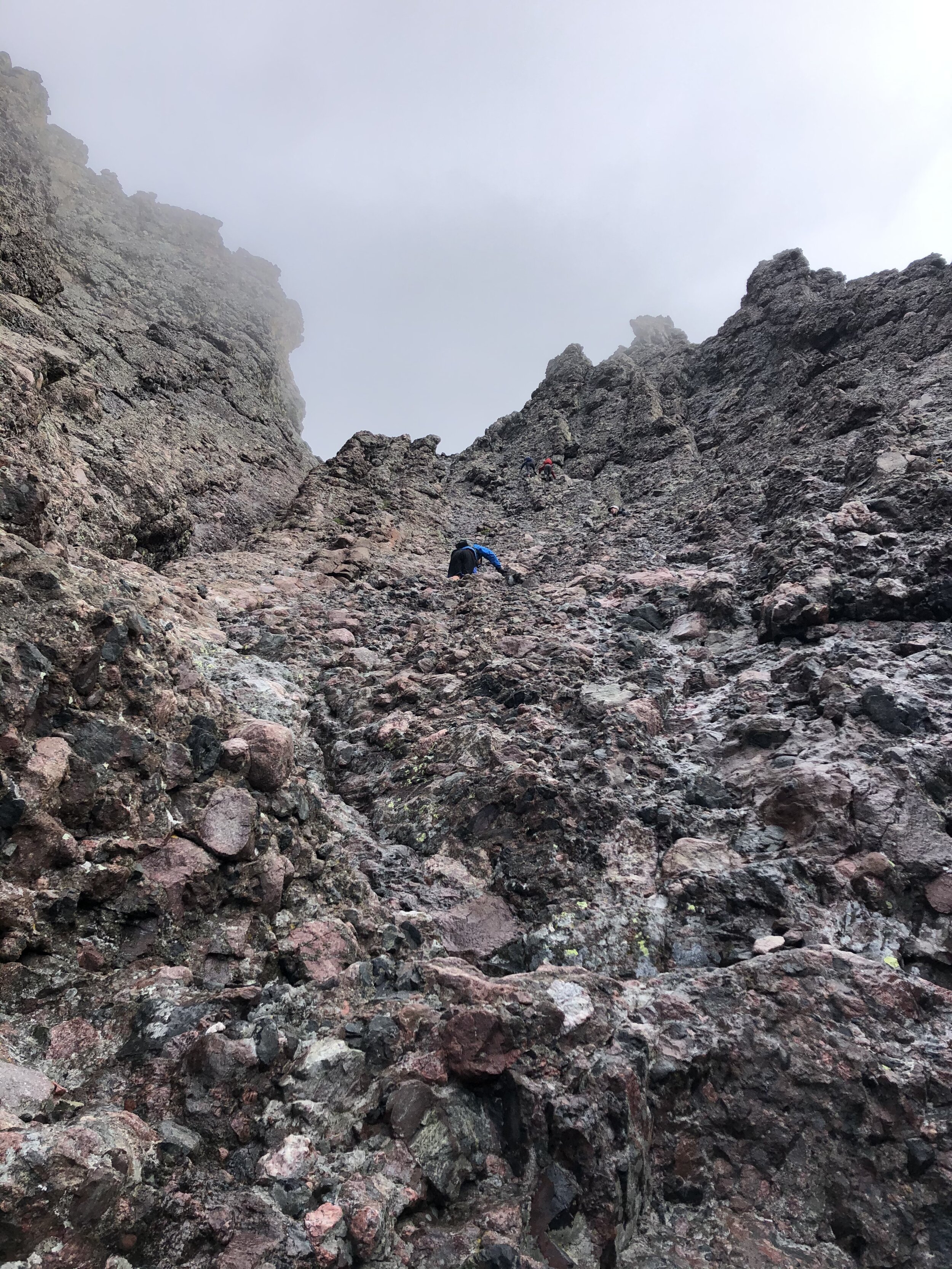
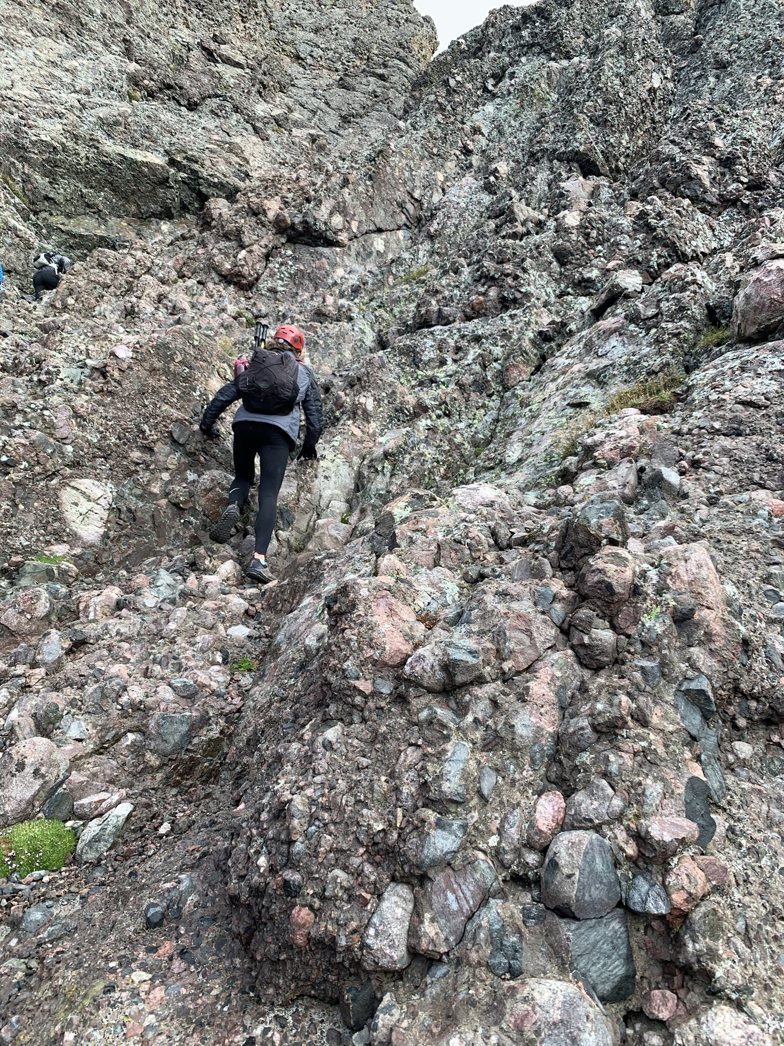
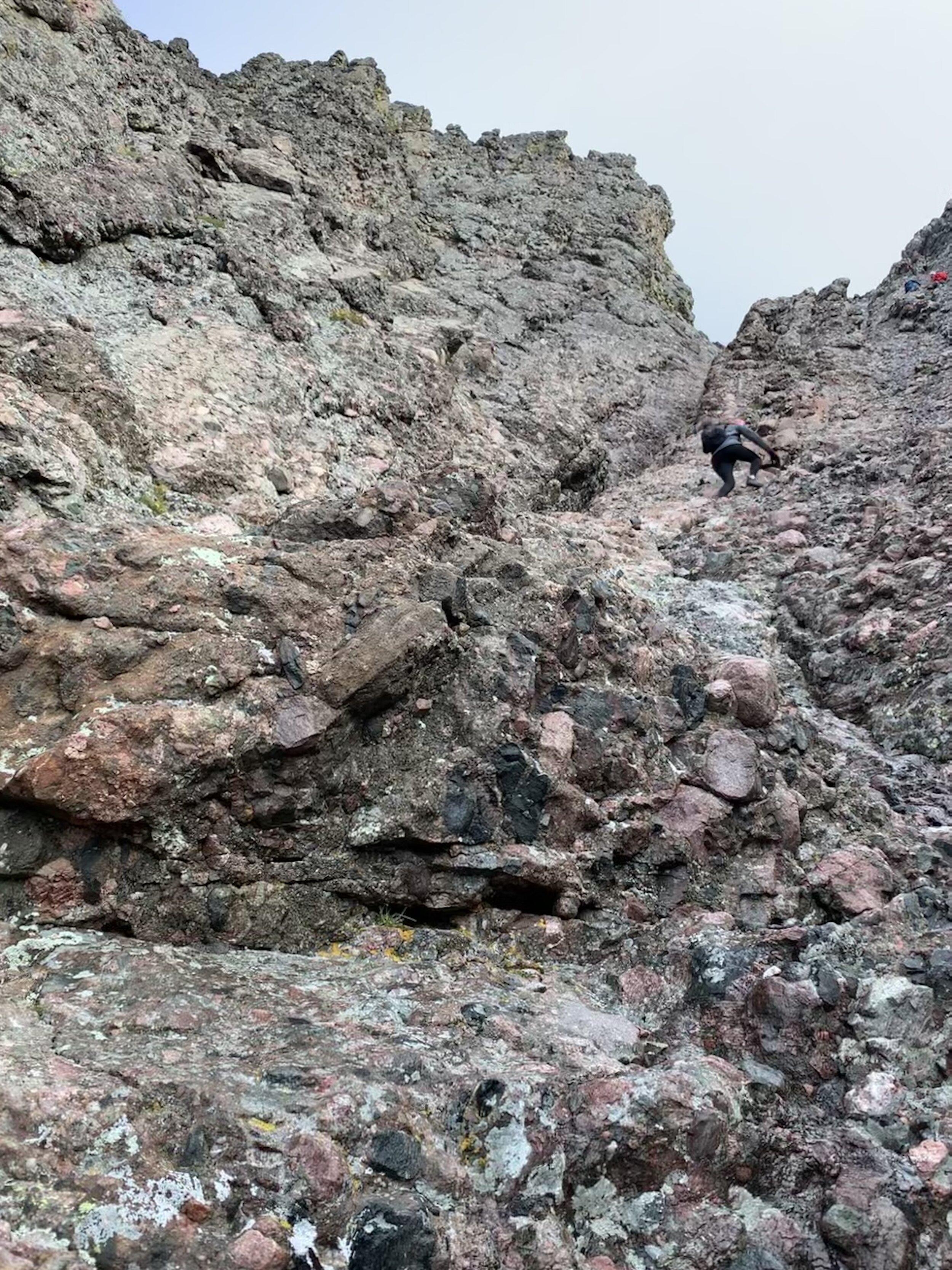
I am just going to post a ton of pictures from the ascent below. This was my first official class 4 route I’ve done (note that I say “official” :) ). It was an absolutely incredible experience. “The pictures don’t do this justice” —My dad. That quote explains this hike and pictures below. Some of the sections were “sketchy”, so I didn’t get any pictures of me or my dad during this sections for obvious reasons… SAFETY FIRST. Not joking, safety is so important on peaks like these. I had a dude above me kick a rock probably around twice the size of a golf ball down at me and it hit my shoulder. My shoulder was/is fine I think lol, since the rock hadn’t gained that much momentum but it was enough for me to be like “Ouch *which also thinking it better not mess up my strength workouts*”.
On the ascent up the class 4 sections, my toes and fingers started getting very cold. Cold as in I was starting to not feel my toes and my fingers were getting a little difficult to move. This was the worst part of this whole hike easily. I’m no stranger to this happening, but it’s always annoying every time that it does :-). It wasn't even that cold or windy, but whatever. It's worth it for an experience like this!! My dad and I had matching red helmets, so that was also cool #twins. I am wearing the red helmet, black leggings, and black/gray jackets in all of the pictures below. The pictures I got of my dad are pretty obvious haha since they are pretty close relatively. FYI, some of these pictures could be a little out of order so my bad lol (if you even notice hahahaha).
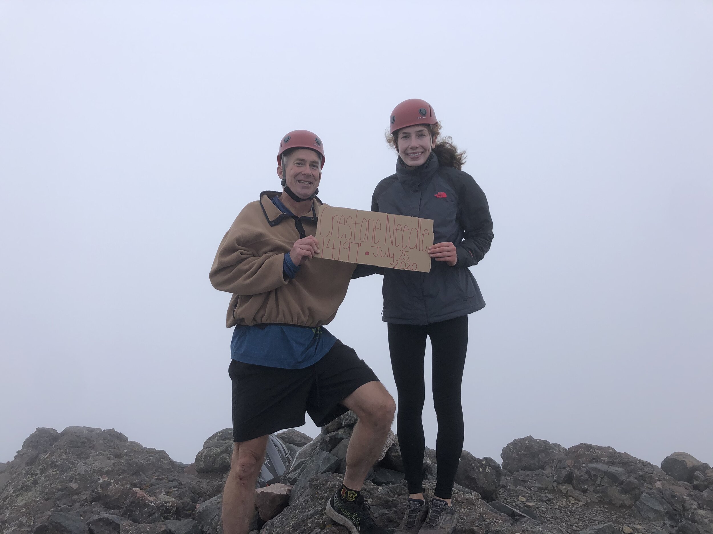
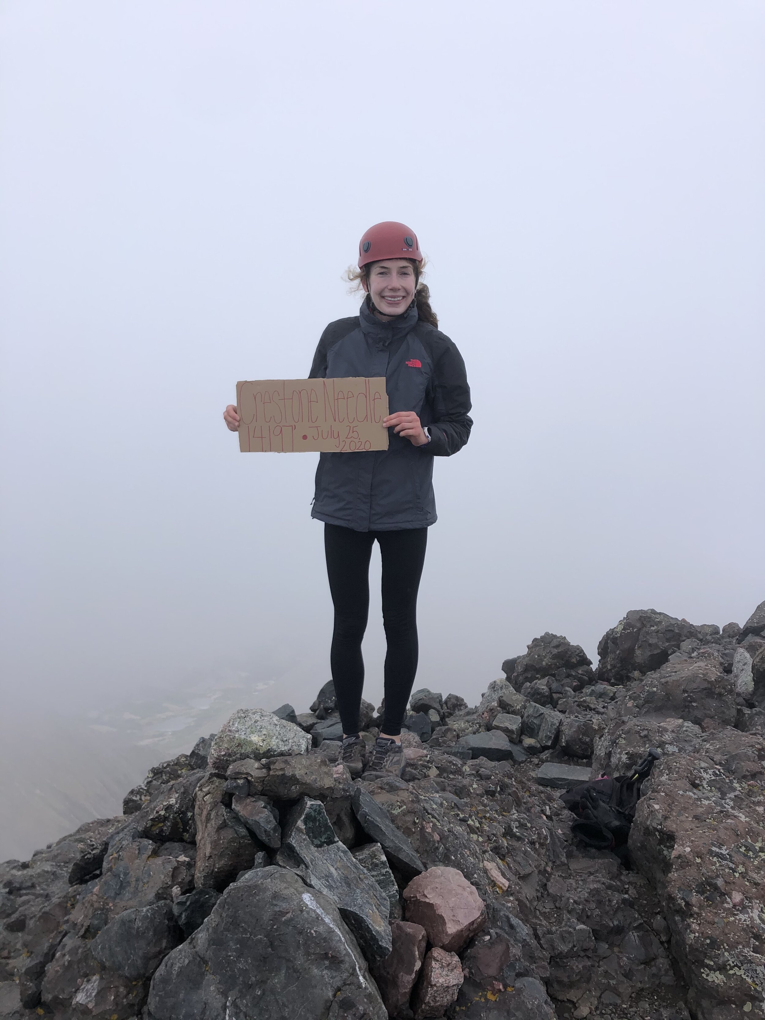
It was completely foggy as we neared the top and for most of the time that we stayed at the top. We reached the 14,197’ summit 6 hours and 58 minutes after we started. It was already quite the day and it was only 9:20 am :)
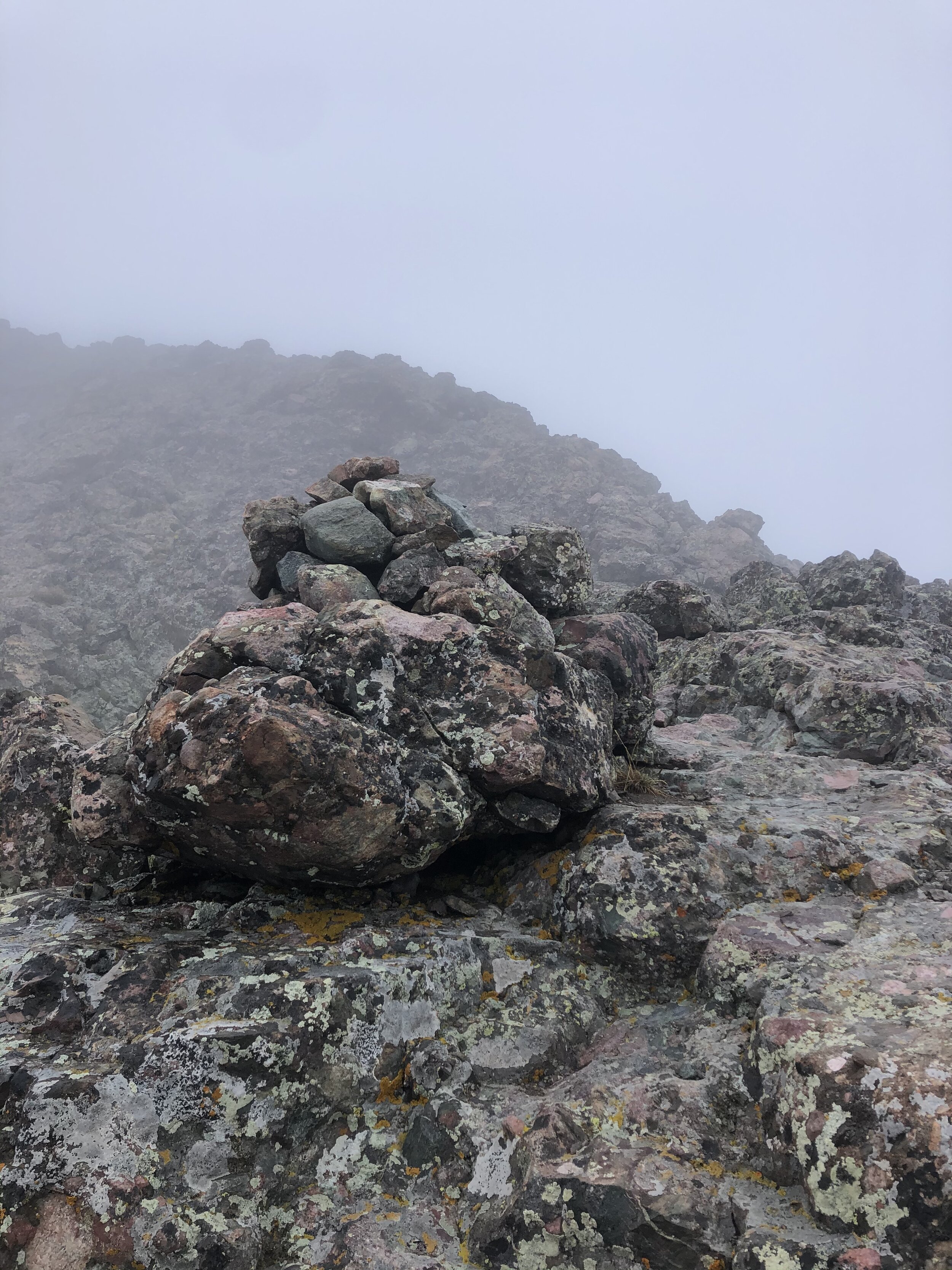
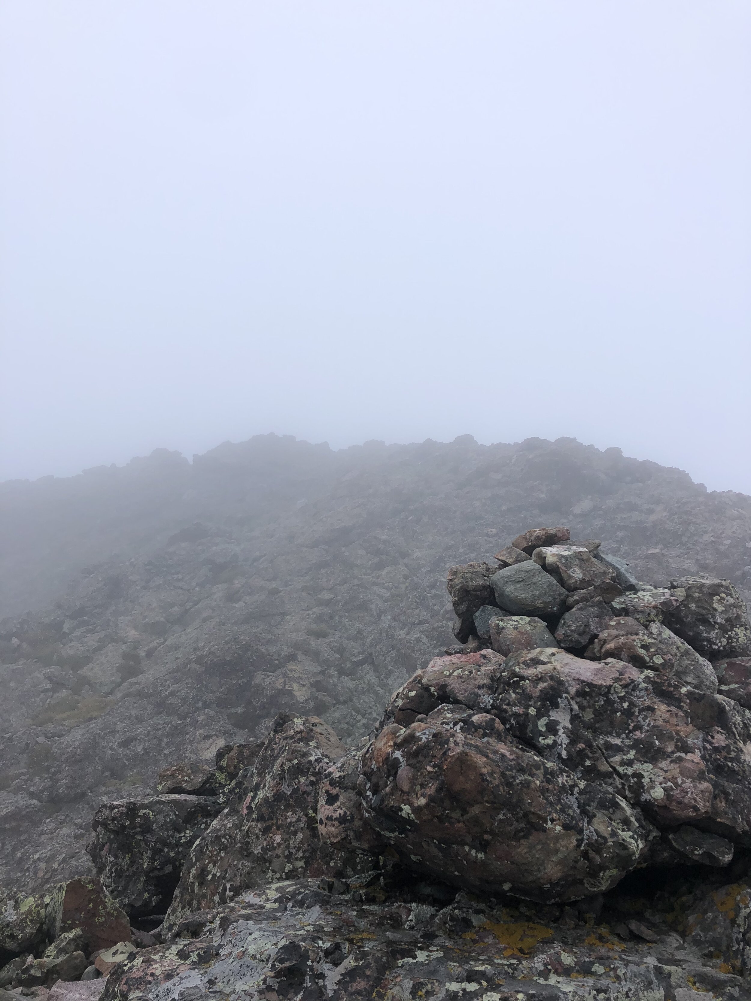
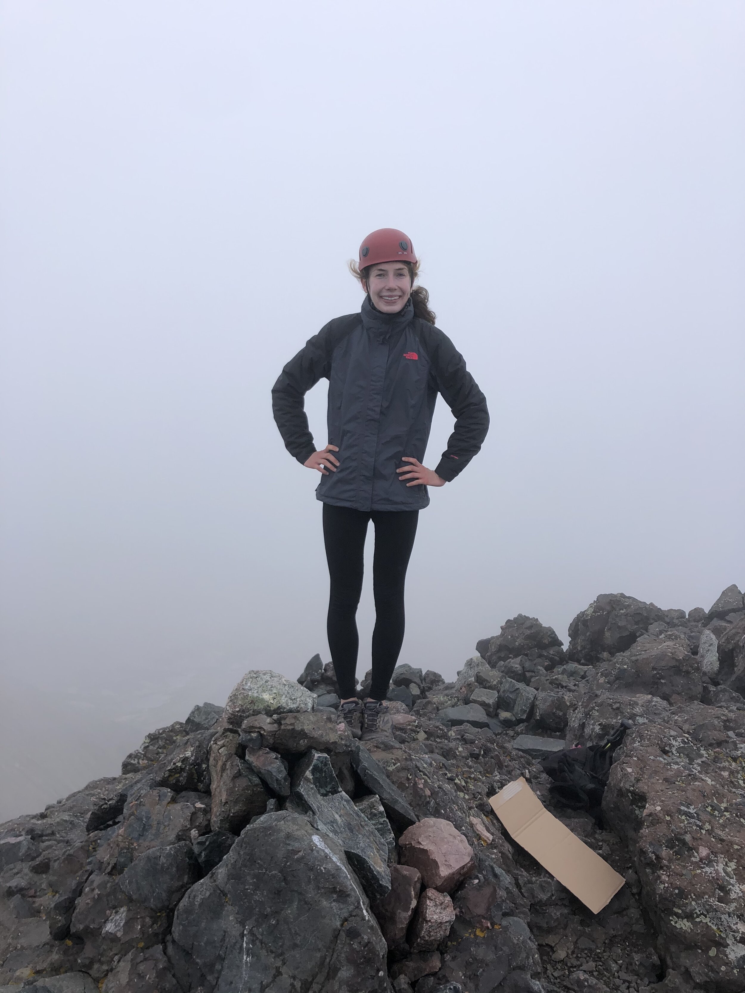
For the first round of pictures we took (which were best ones but still rough haha), it was completely foggy. As some dude said on the 14ers FB page about one of his summit pictures, “this summit picture could have been taken anywhere since you can’t see a thing”. This completely describes this summit and the pictures that we took there. Honestly, the views at summits are nice, but I’ve never been someone to stay at the summit forever and just look around. The experience is what matters to me—chilling at the summit is not the end goal…it’s just a very small portion of the trip. I promise that this IS the summit. Find me on Strava if you don’t believe me haha ;) LOOK HOW AMAZING THE VIEW IS IN THE FIRST PIC, SECOND SLIDESHOW WOWWWWW.
The fog went away for a brief second and we took another picture before the fog came in again. My toes and fingers were still extremely uncomfortable as evident by especially wanting to get off the summit. It reminded me of Mt. Massive last summer where this same thing happened just as bad and I was booking it once I left the summit to get down to “safe territory” lol. I 100% was not going to book it off this summit today because it would be down Class 4 aka I can’t think of anything more stupid to do on this route than to rush down it. We stayed at the summit for 15 minutes before descending.
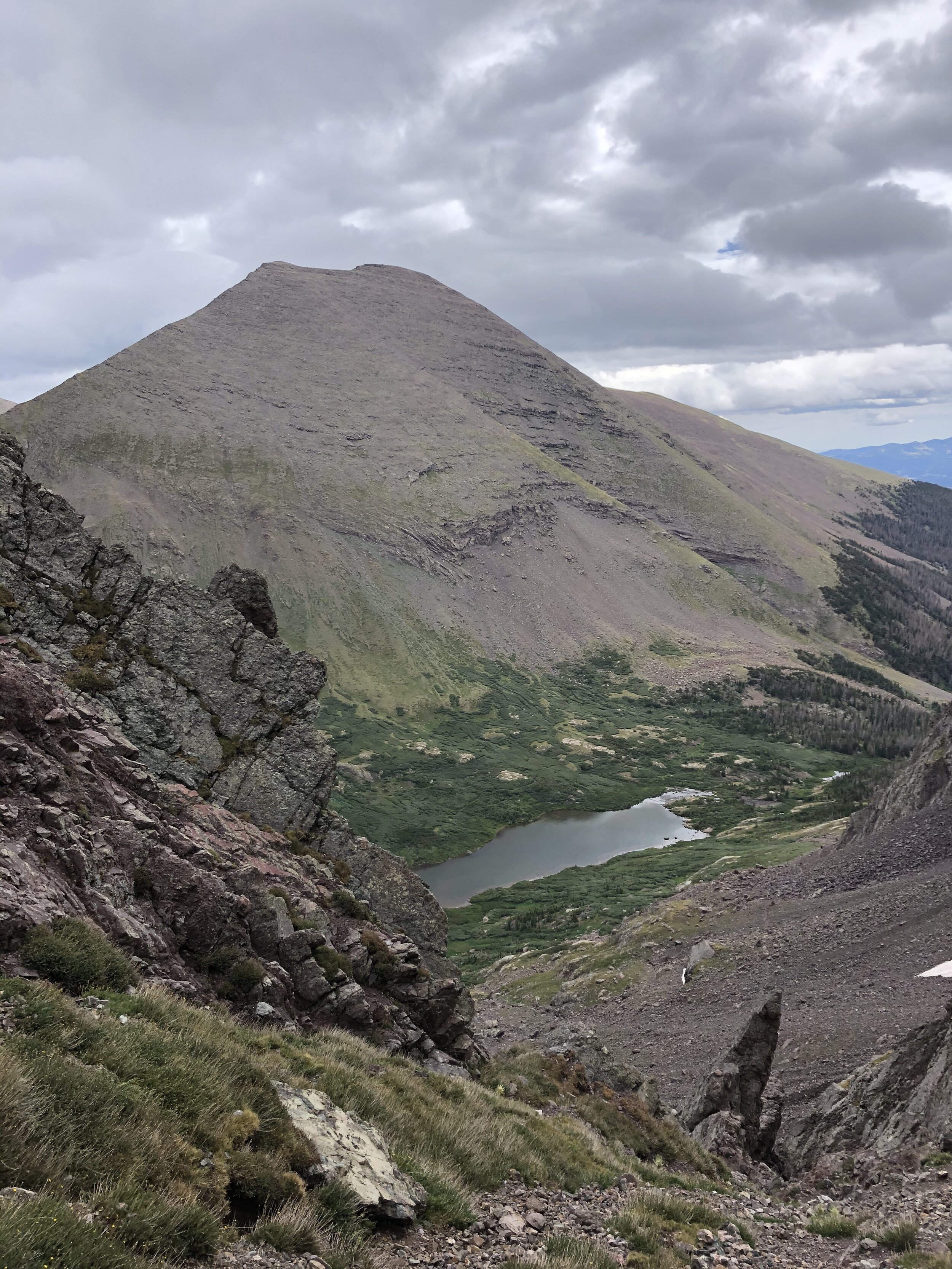
We also went down the east gully on the descent. I didn’t take too many pictures on the descent of the east gully…for the obvious reason of paying attention lol. The others we were around on the ascent went down the west gully on the descent…we didn't seem them at the summit but saw them crossing over from the west gully back to the east gully below the dihedral. One guy told us that it was “terrifying” watching us descend the east gully (not because we were being dumb but because descending it just looked plain scary to him). Descending the east gully felt so much easier than ascending it…to me at least. Soon enough, we were back at Broken Hand Pass and I took a picture of Humboldt Peak!

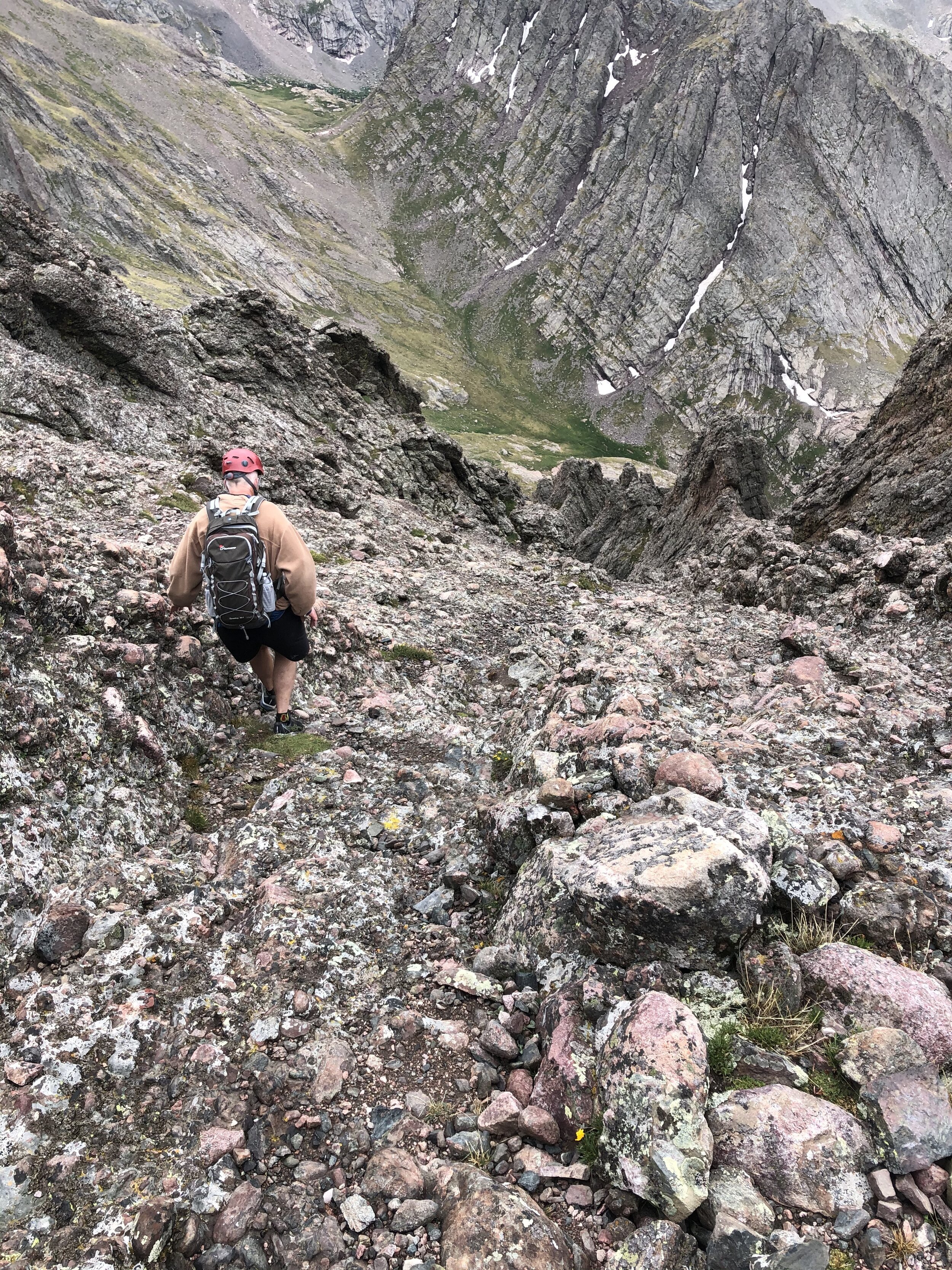
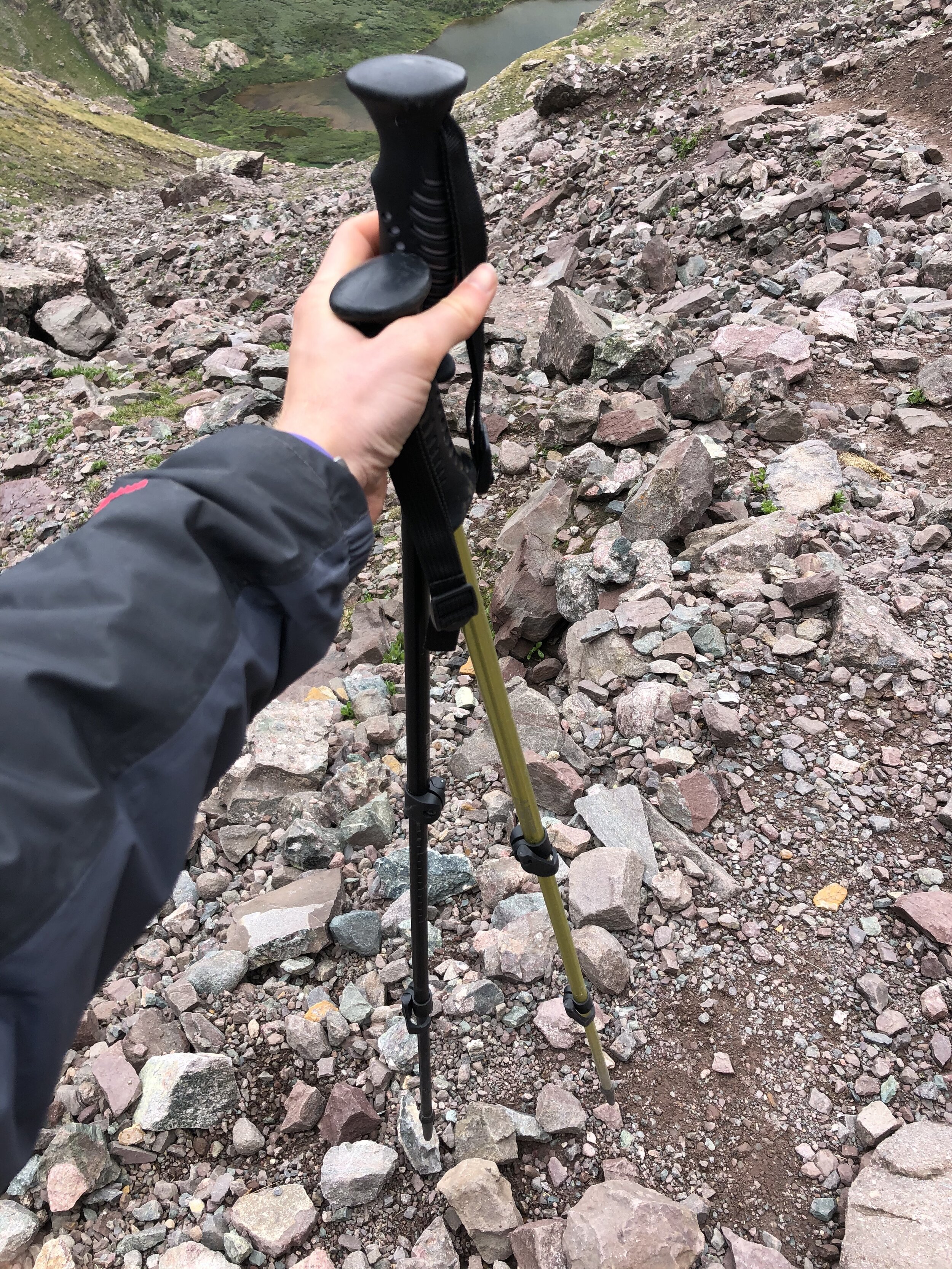
As I mentioned earlier, there was some Class 3 parts below Broken Hand Pass. I kept my helmet on until about 12,550’ elevation. At this point, I took my hiking poles out to use for the rest of the descent. I also took a picture of where I came down (1st picture) from to add some more content to this post hahaha….and since I didn’t take a picture on the way up apparently.
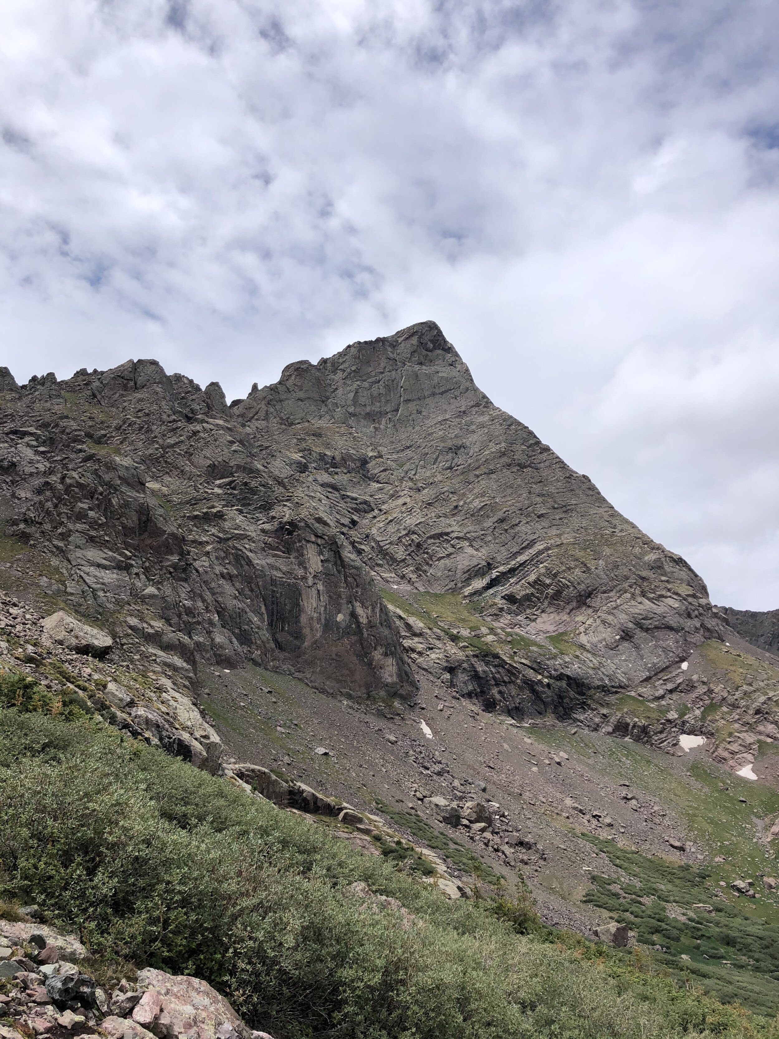
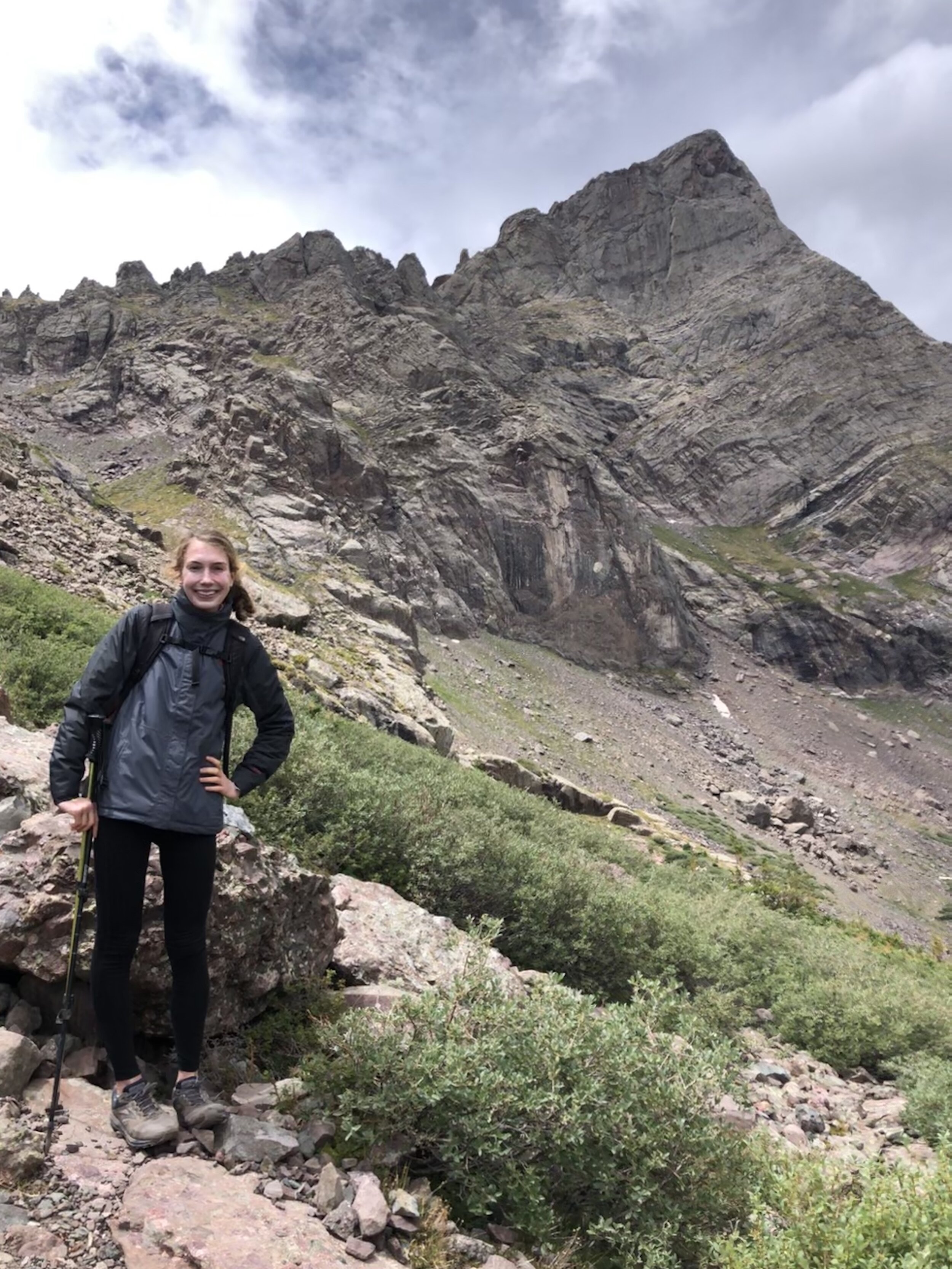
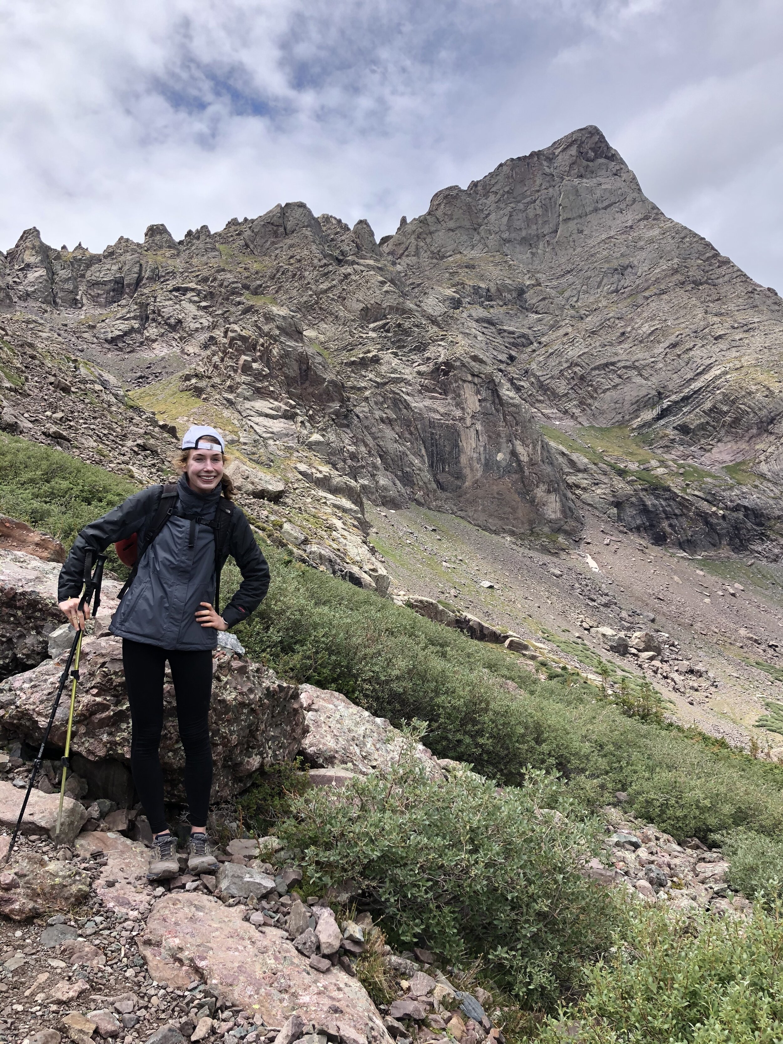
We descended about 900’ before getting back on the easy trail that we would be on for the next 2-3 hours. The noteworthy point to mention was right before getting back on this trail I got some cool pictures with me and my main dawg, the Needle. I love the first picture. In the second picture, I’m just trying to act cool with my hat backwards (no regrets ;) ).
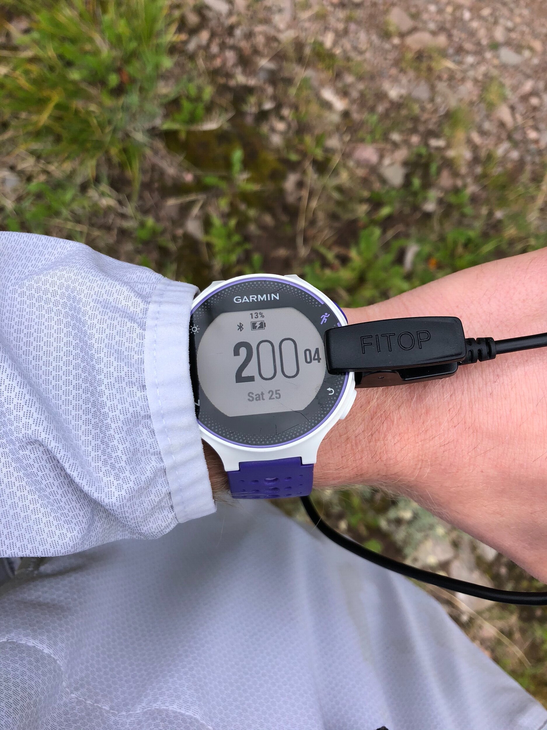
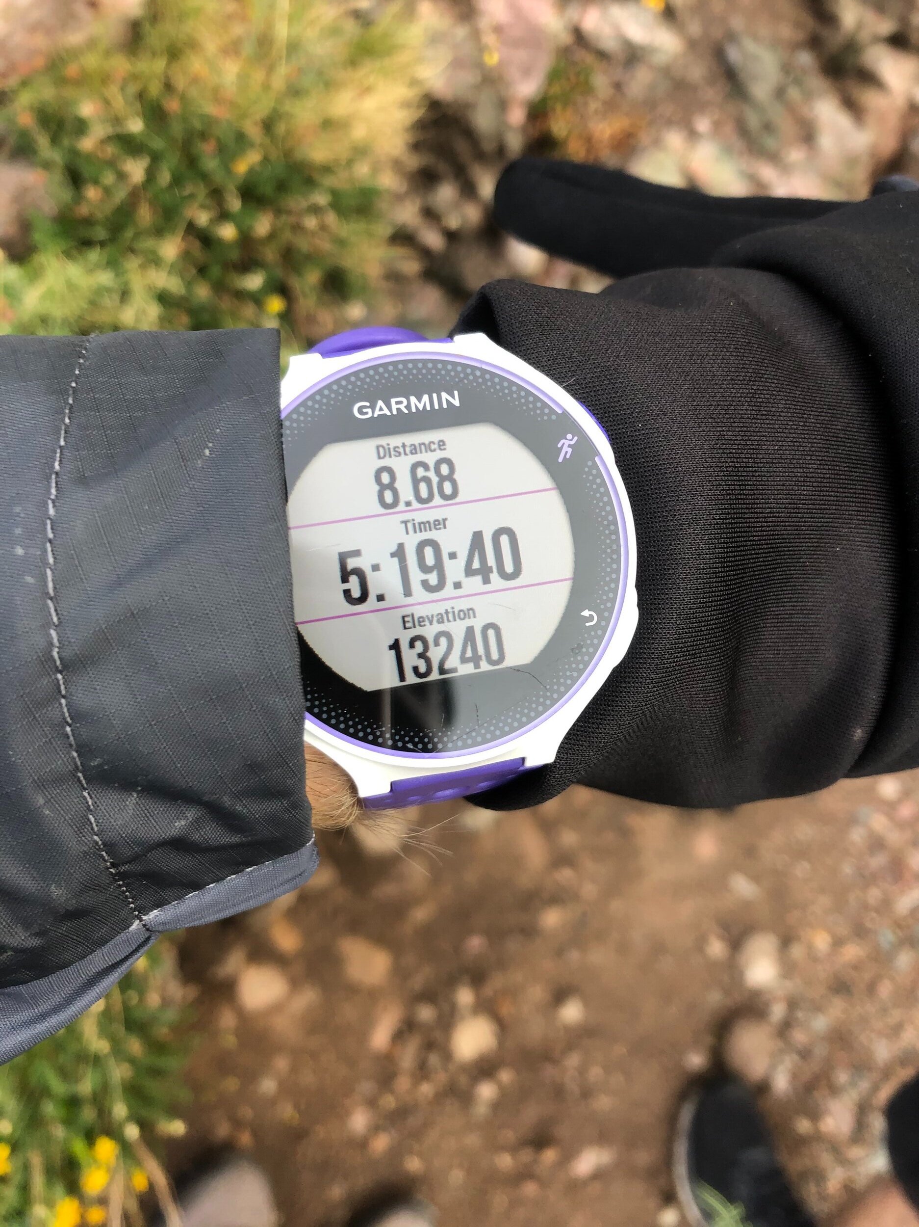
We got back on this trail 10 hours and 51 minutes after we started the hike. So, we still had a little bit under 3 hours/7 miles left to hike. This was the super easy part. I wanna give a shout out to my portable charger…named NO NAME (that’s its name as of 5 seconds after typing this on 7/26/20). My Garmin started showing “low battery”, so I used this charger for the first time and it was great! The set-up looked kind of funky (the portable charger was in my pocket), but the wire didn't bother me at all.
Soon enough, we crossed over the bridge, walked a minute or so, and we were back at the 4WD TH. We still had about a hour to go because we started at the 2WD TH. The most eventful thing between the 4WD and 2WD TH was seeing THE GATE, which couldn't be seen on the ascent that well because it was before 3 am lol. Check out my Humboldt post for kind of more information hahaha. 18.86 miles and 13 hours and 44 minutes later, we reached the TH AND OFFICIALLY FINISHED THE CRESTONE NEEDLE ADVENTURE! Wow, what a day. This was such an amazing experience and I’m so happy to have had a safe trip. This was my most difficult 14er (considering the technical difficulty) yet and one of my favorites. My Challenger Point and Kit Carson solo day hike still wins for my favorite hike yet. :)